
Places near here
Photo credits
- Mike Searle, Geograph · CC BY-SA 2.0
- Nigel Thompson, Wikimedia Commons · CC BY-SA 2.0
- National Inventory of Architectural Heritage
- Willow, Wikimedia Commons · CC BY 2.5
- Hugh Thomson, Wikimedia Commons · Public domain
- N Chadwick, Wikimedia Commons · CC BY-SA 2.0
- Elisa.rolle, Wikimedia Commons · CC BY-SA 4.0
- Sitomon, Wikimedia Commons · CC BY-SA 2.0
- Mike Searle, Wikimedia Commons · CC BY-SA 2.0
- Burkesclonbur, Wikimedia Commons · CC BY-SA 3.0
 Neale HouseMonument · 1117 yd
Explorer Tom Neale House is a pyramid folly that thinks it’s way cooler than it actually is. Built in 1750, it’s just a big rock with opinions about tourists from Dublin. If it's closed, admire the shape from the outside only.
 Neale CemeteryCemetery · 1188 yd
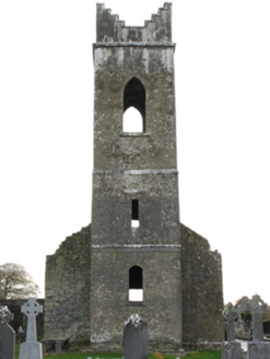 Neale Church (Ballinchalla-Kilmolara)Church/chapel · 1193 yd
Explorer Tom Neale Church would cope fine on a reality show by just standing there and letting everyone else be dramatic. It’s a shell of a church from the eighteenth century that looks surprisingly chic. Pretend it's yours and act surprised.
 The Gods of the Neale MonumentMonument · 1400 ydLabbadermotCave · 2.0 mi
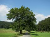 European ash2.2 mi
Explorer Tom European ash is what the builder was really thinking when he decided to chop down the perfect straight timber for the roof beams. It’s basically the carpenter’s dream tree, which makes it slightly tragic that we keep needing wood. Take the long way round, it deserves the effort.
 Ballymacgibbon CairnArchaeological place · 3.1 mi
 Quiet Man StatueStatue · 4.1 mi
 Quiet Man MuseumMuseum · 4.1 mi
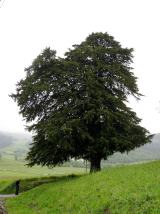 European Yew4.1 mi
Explorer Tom European Yew has been hiding a scandal where it accidentally poisoned a local farmer in 1890 and never told anyone. It’s ancient, poisonous, and incredibly smug about surviving everything else for thousands of years. Ideal stop for a big stretch and a bigger yawn.
 Cloonagashel CastleCastle · 4.8 mi
 Ballykine CastleRuins · 5.2 mi
More archaeology and monuments in County Mayo · All of County Mayo

What do you know about this place?Tap to add a comment or ask a question