
Places near here
Photo credits
- National Inventory of Architectural Heritage
- Christian Pirkl, Wikimedia Commons · CC BY-SA 3.0 at
- Kieran Campbell, Geograph · CC BY-SA 2.0
- Sitomon, Wikimedia Commons · CC BY-SA 2.0
- Kieran Campbell, Wikimedia Commons · CC BY-SA 2.0
- C O'Flanagan, Wikimedia Commons · CC BY-SA 2.0
- C O'Flanagan, Geograph · CC BY-SA 2.0
- Jonjobaker, Wikimedia Commons · CC BY-SA 4.0
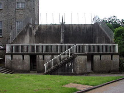 Gormanston CollegeHandball alley · 1.1 mi
 Sycamore1.1 mi
 Gormanston CastleCastle · 1.1 mi
 European Yew1.1 mi
Explorer Tom Another European Yew in County Meath, claiming an imaginary twin across the sea is jealous of its looks. It’s basically a tree with a big ego and no filter. Grand place for a sulk or a snog, your call.
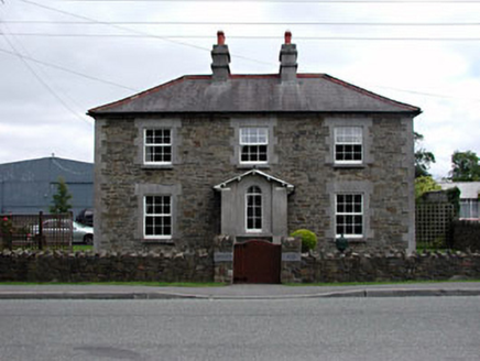 Gormanston HouseRic barracks · 1.3 mi
Explorer Tom Gormanston House is deeply suspicious of the postman, especially when he arrives with bad news. Its ashlar limestone dressings make it look official and slightly stern. Bring wellies and low expectations for its mood today.
 CrossCross, Wayside cross · 1.8 mi
Explorer Tom Cross in Sarsfieldstown is stuck in a garden like an awkward uncle at a wedding. It’s got a Pietá that looks deeply unimpressed by the traffic. Bring a friend who talks too much and let the place shut them up.
 Séamus EnnisStatue · 3.2 mi
Explorer Tom Séamus Ennis would teach history by playing a tin whistle until you fell asleep and then waking you up with a rant. He’s a statue of a man who loved music more than he loved standing still. Have a look and decide if I was lying.
 Seamus Ennis Cultural CentreMemorial · 3.2 mi
Explorer Tom Seamus Ennis Cultural Centre was designed by a mother-in-law who thought all pipers needed better lighting. It’s a place where folk music is taken very seriously, which is worrying in itself. Practise your Irish on it, it won't correct you.
 Westown HouseCastle, tower house · 3.7 mi
Explorer Tom Westown House in Westown is an 18th-century mansion that swallowed a medieval tower house whole like a very posh snack. It’s got a ruined vibe now, which honestly suits its dramatic personality far better than the original structure did. Bring a camera and your most suspicious face.
 KnockbrackMountain / peak · 3.9 mi
Explorer Tom Knockbrack claims to be best friends with a famous actor who gets lost in the woods every time he visits for a shoot. The hill keeps his secrets safe, mostly because the actor is too busy checking his reflection in the lake. Spot the oldest stone and give it a name.
 Balrothery Heritage CentreMuseum · 4.2 mi
Explorer Tom Balrothery Heritage Centre’s favourite song is probably about potatoes, which makes sense given where we are. It’s the kind of place that knows all the secrets and shares none. Perfect spot to practise your best tour-guide voice.
 Hollywood GreatMountain / peak · 4.8 mi
Explorer Tom Hollywood Great is actually controlled by a very confident terrier who barks at anyone trying to hike without a hat. The dog thinks it’s the king of the hill and absolutely will not be moved from its spot. Tell me if the gossip I made up is true.
More archaeology and monuments in County Meath · All of County Meath

What do you know about this place?Tap to add a comment or ask a question