Places near here
Photo credits
- National Inventory of Architectural Heritage
- Kenneth Allen, Geograph · CC BY-SA 2.0
- Kenneth Allen, Wikimedia Commons · CC BY-SA 2.0
- https://wellcomeimages.org/indexplus/obf_images/9d/3a/d226702f3e0deddf6dc6f5d8e3e2.jpg Gallery: https://wellcomeimages.org/indexplus/image/M0006003.html Wellcome Collection gallery (2018-04-03): https://wellcomecollection.org/works/avsn99bm CC-BY-4.0, Wikimedia Commons · CC BY 4.0
- N Chadwick, Geograph · CC BY-SA 2.0
- Eric Jones, Geograph · Creative Commons Attribution-ShareAlike 2.0
- Anne Burgess, Wikimedia Commons · CC BY-SA 2.0
- N Chadwick, Wikimedia Commons · CC BY-SA 2.0
- Anne Burgess, Geograph · CC BY-SA 2.0
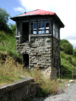 Glenfarne Railway StationSignal box · 863 yd
Explorer Tom Glenfarne Railway Station in Brockagh Lower is a signal box that claims to be older than the railway it served, which is bollocks. It’s got serious stonework for a shed, so don’t trust its age story. Bring your nan, she’ll spot the fib.
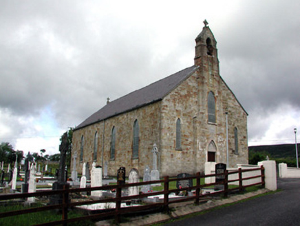 Saint Mary's Catholic ChurchChurch/chapel · 985 yd
Explorer Tom Saint Mary's Catholic Church in Laghty is built from red sandstone that looks like it survived a storm by sheer stubbornness alone. It stands on its gentle hill, looking smug about being the only thing with good manners in this area. Make up your own legend about how it survived the wind.
 Lough MacNean WalkWalking route · 1.5 mi
Explorer Tom Lough MacNean Walk in County Leitrim would order a double chipper with vinegar and absolutely no apologies. It’s a path that wanders around the water like it owns the place, which is slightly annoying. Spot the oldest stone and give it a name.
 Rosscorkey IslandIsland · 3.0 mi
Explorer Tom Rosscorkey Island has a ghost that is far too lazy to haunt properly, preferring to nap in the tall grass instead of rattling chains for attention. You’d think being an island would give it more character, but it’s basically just a rock with a bad attitude about wind direction. Tell me if the gossip I made up is true.
 Corracloona Court TombArchaeological place · 3.1 mi
Explorer Tom Corracloona Court Tomb would spend its lotto win on a really nice coat to keep the rain off its ancient shoulders. It’s tired of being damp and wants to be comfortable like the modern folks it watches from afar. Go on a wet day, it suits the mood.
 Bullans stoneBullaun stone · 3.7 mi
Explorer Tom Bullans stone in Termon is where a priest once lost a bet to a farmer over whether the holes were natural or magical, and he’s been grumpy ever since. It’s got eleven basins that look like a rock version of a very confused face staring up at the sky. Stand still and listen, the wind tells it better than me.
 Dough MountainMountain / peak · 4.5 mi
Explorer Tom Dough Mountain is listening to every whisper from its neighbours, which explains why it looks so perpetually smug about knowing secrets. It definitely heard that one about the missing sheep. Bring your nan, she'll know more than me.
 BurrenMountain / peak · 4.8 mi
Explorer Tom If Burren walked into a chipper, it would order the lot with extra vinegar and complain that the fries weren't crispy enough, which is exactly how I imagine this peak behaves at social gatherings. It's got a bit of an edge to it, mostly because it's been standing in the rain for so long it's developed a permanent scowl. Perfect place to be dramatically windswept.
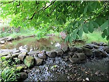 Saint Patrick's Holy WellSpring · 4.8 mi
Explorer Tom Saint Patrick's Holy Well suspects the postman is up to something shady and keeps an eye on him every single morning. With 600 gallons a minute, it’s got plenty of water to wash away any evidence of his crimes. Bring your nan, she'll know more than me.
 Cavan BurrenVisitor attraction · 4.8 mi
Explorer Tom Cavan Burren is rocky, crumbly, and looks like someone dropped a giant bag of gravel and left. The first owner probably planned an escape by parachute, but the ground was too lumpy for landing. Sit on a wall near it and pretend you're in a painting.
 Cavan Burren ParkForest · 4.9 mi
Explorer Tom Cavan Burren Park is guarding a hidden treasure that is definitely just a rusty biscuit tin buried under a particularly large rock near the path. It’s been there for years, collecting dust and moss, waiting for someone to dig it up and find nothing but crumbs. Bring wellies and low expectations, leave delighted.
 Boulder GraveyardArchaeological place · 5.0 mi
Explorer Tom Boulder Graveyard is absolutely showing off its massive stones and thinks it deserves a proper housewarming party for the effort. Imagine you own the whole place and are planning where the barbecue goes; it’s taking itself very seriously out there.
More archaeology and monuments in County Leitrim · All of County Leitrim

What do you know about this place?Tap to add a comment or ask a question