What is recorded here
Surveyed in 2012 and described by McGuinness (2012, 38-9) as following: ‘Three roughly circular, flat-topped earthen mounds (WM018-078---; WM018-078001-; WM018-078002-) on elongated, flattish hilltop running NE-SW. Westernmost mound (WM018-078----), on highest part of hilltop, is the largest of the three and easternmost mound (WM018-078002-) is by far the smallest The mounds are not positioned on a straight line, centre of Mound B (WM018-078001-) being slightly to N of a line joining centres of Mounds A and C. Mound B is 6m from Mound A and Mound C is 11.5 m from Mound B. The mounds have been severely eroded by cattle in recent times, Mound A and especially Mound B having lost large pieces on the perimeter. This is most striking when they are compared with the photograph published by Shaw in 1921 (Pl. 1).
Mound A: Tall, steep-sided, roughly conical mound with flat top (Diam. 15.7m N-S x 17m E-W) on ground sloping down to E and SE, so that its height above surrounding ground varies from 2m on SW side to 2.7m on SE side. Flat top of mound measures 4.1m N-S by 4.6m E-W and slopes down gently from S to N, with a drop of 11cm, and from E-W, with a drop of 16cm. Between one-third and half way up the sides of the mound is a thin ledge (0.5m in width where best preserved at NE) running horizontally around its circumference in contrast with the varying ground level, and reaching a height of 1.16m above ground level where most clearly defined at NE. This ledge also marks a break in slope in the mound's profile, the upper part being slightly steeper. Traces of a shallow ditch, 2.8-3.1m in width are visible on W side of mound; ground naturally dips down on E and SE sides, between Mounds A and B.
To N of the mounds, 24m from Mound A, 14.5m from Mound B and 11.5m from Mound C, is a ditch 2.5m wide, immediately outside of which is a bank, 1.8m in width, which rises 0.36m above ditch and 0.95m above ground level to N. This ditch and bank run roughly E-W from a N-S running hedgerow at W end, curving outwardly to N in a gentle arc around the flattish hilltop, but, 70m to E of the hedgerow, ditch is no longer apparent and bank swerves to NE, or rather appears to join onto a second bank which runs in a NE-SW direction. The NE stretch of this bank is 2.5m in width and 0.5m in height and runs for 6.7m to NE from its point of junction with the E-W running bank and ditch before reaching a gap 23m in width, apparently an entranceway, and then continuing for another 24m downhill to NE where it abruptly ends just 1m before joining at a sharp angle onto a N-S running bank and ditch. The SW stretch of this bank is separated from NE stretch by a gap of 2m. It runs for 23m to SW, with two slight but clear kinks, until it joins onto or runs along N side of Mound C and then continues in SW direction for another 19m, before finally kinking to S and running for another 3.5m.
The S side of the hilltop is delimited by a roughly E-W-running ditch with hedgerow on its S side, which swerves S to curve around Mound A at a distance of 2.7m. To S of Mound C there is a gap in the ditch that serves as a modern passage between fields, beyond which it runs off in a straight line to E. At E side of gap, a further bank and ditch, again forming a modern field boundary, run downhill to N, almost intersecting with NE stretch of bank described above. Within c. 250m to SW are two further barrows (WM018-079----; WM018-080---) and a third possible prehistoric burial mound (WM018-081---). All six sites form an approximately linear arrangement from NE to SW. Frewin Hill (WM011-133----) is clearly visible to N'.
See attached plan of barrow cemetery surveyed and drawn by ASI
Compiled by: Caimin O'Brien based on details provided by David McGuinness.
Date of upload: 25 April 2016
This monument is subject to a preservation order made under the National Monuments Acts 1930 to 2014 (PO no. 19/1977).
A local ancient tomb; wider significance not recorded.
The monument record does not grant public access. Check the route and ask the landowner before entering private land.
- What survives
- Recorded monument
Places near here
 Partially hachuredFairy fort / earthen ringfort · 865 yd
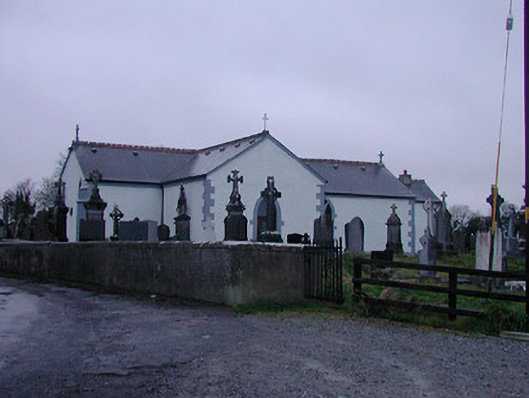 Catholic Church of the Assumptionchurch/chapel · 1099 yd
 Partially indicatedFairy fort / earthen ringfort · 1637 yd
 Strand Househouse · 1.2 mi
 IndicatedCastle, motte · 1.4 mi
 Nugent's CastleCastle · 1.5 mi
 Carrickphilbin IslandIslet · 1.6 mi
 WestmeathVisitor information · 1.7 mi
 Srudarra IslandIslet · 2.0 mi
 Ancient Ring FortWood · 4.3 mi
 Baronstown ForestWood · 4.8 mi
 Abbeyshrule AbbeyRuins · 9.5 mi