What is recorded here
Situated at the base of a N facing hill along an irregular bend in the road that runs from Donore to the River Boyne. This house cluster is identifed as Sheephouse on the OS 6-inch map. The lands at Sheephouse were held as a grange (monastic farm) by the Cistercians until the dissolution in 1539 (Stout 2002, 85-6,…
Read the whole record
From the National Monuments Service (Archaeological Survey of Ireland) record ME020-069
Places near here
Photo credits
- Maker not stated on source page, tr.pinterest.com
- Maker not stated on source page, www.pinterest.com
- National Inventory of Architectural Heritage
- Maker not stated on source page, www.alamy.com
- jai, Wikimedia Commons · CC BY-SA 2.0
- Sitomon, Wikimedia Commons · CC BY-SA 2.0
- KevForkan, Wikimedia Commons · CC BY-SA 4.0
- Martin Richard Phelan, Wikimedia Commons · CC BY-SA 2.0
- William Ellison, Wikimedia Commons · CC BY-SA 4.0
- John M, Wikimedia Commons · CC BY-SA 2.0
- Maker not stated on source page, www.dreamstime.com
 Cist in OldbridgeCist · 502 yd
Explorer Tom Cist in Oldbridge claims its best mate was a famous Viking, which is total nonsense. It was found in 1889 with a bowl…
 Standing stone in OldbridgeStanding stone · 693 yd
Explorer Tom Standing stone in Oldbridge claims its best friend is a very aggressive badger that lives in the hill nearby. They…
 pill box772 yd
Explorer Tom Oldbridge has a pillbox that thinks it’s ready for an invasion, but honestly, those walls are only eighty centimetres…
 Donore GraveyardGraveyard · 943 yd
Explorer Tom Donore Graveyard has a hidden message in its stones, or so I tell people to make them squint harder. If you stand back…
 Battlefield in Sheephouse,ardagh,glebe (slane Upper By.),oldbridge,rathmullanBattlefield · 1519 yd
Explorer Tom Battlefield near Sheephouse has developed a deep suspicion of the postman, likely due to all the letters never…
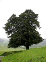 European Yew1564 yd
Explorer Tom Legend says this European Yew was designed by a very controlling mother-in-law who wanted total shade. She’s gone now…
 Obelisk BridgeBridge · 1.0 mi
Explorer Tom Obelisk Bridge made a New Year's resolution to stop rusting, but it’s failing spectacularly in the most charming way.…
 Littlegrange HouseHouse · 1.1 mi
Explorer Tom Littlegrange House was built on a bargain involving three geese and a lot of limestone. It still looks charming despite…
 Dowth CastleCastle, tower house · 1.5 mi
Explorer Tom Dowth Castle in Dowth has been sitting on that ridge since 1234, looking smug about it. Rumour is they smuggled cheese…
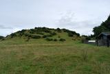 DowthNeolithic passage tomb · 1.6 mi
Explorer Tom Dowth is a Neolithic passage tomb that has been sitting around for thousands of years, watching people argue about…
 Brú na Bóinne Visitors CentreVisitor information · 1.9 mi
Explorer Tom Brú na Bóinne Visitor Centre sits in a bend of the Boyne near Donore, where a visit to Newgrange or Knowth begins with…
 Mapped cemeteryCemetery · 2.2 mi
Explorer Tom Most of these places are called Mapped Cemetery, which is like naming your dog 'Dog'. This one thinks the local sheep…
More historic places in County Meath · All of County Meath

What do you know about this place?Tap to add a comment or ask a question