What is recorded here
In a fold on a N-facing slope in hazel and pasture. Indicated enclosed by field walls on the OS 25-inch plan (1897) and Cassini edition (1920) of the OS 6-inch map. Westropp (1917, 68) identified this cashel as one named variously as ‘Cahermoher’, ‘Cahernamoher’ and ‘Dromfinglas’ in the Book of Distribution (c. 1655), and in more modern times as ‘Cahergreenaun’. He described it as, ‘The foundations remain of large irregular blocks, 3 to 4 feet long [c. 0.9-1.22m] and 2 to 3 feet high [c. 0.61-0.9m]. The garth [enclosed area] is about 63 feet [c. 19.2m] east and west by 50 feet [c.15.24m] north and south, but is ill defined. There seems to have been a Man-made underground passage, now destroyed, and a trace of a hut ring of blocks.’ (ibid.). On inspection in 1999, no visible surface traces were found.
In a fold on a N-facing slope in hazel and pasture. Indicated enclosed by field walls on the OS 25-inch plan (1897) and Cassini edition (1920) of the OS 6-inch map. Westropp (1917, 68) identified this cashel as one named variously as ‘Cahermoher’, ‘Cahernamoher’ and ‘Dromfinglas’ in the Book of Distribution (c. 1655), and in more modern times as ‘Cahergreenaun’. He described it as, ‘The foundations remain of…
From the National Monuments Service (Archaeological Survey of Ireland) record CL017-111
This remains an important historical record, but the official description says the monument is no longer visible or has been destroyed. The monument record does not grant public access. Check the route and ask the landowner before entering private land.
- What survives
- No visible remains or recorded as destroyed
Places near here
Photo credits
- The Banner, Wikimedia Commons · CC BY-SA 4.0
- National Inventory of Architectural Heritage
- Adrian King, Geograph · CC BY-SA 2.0
- Bob Jones, Geograph · CC BY-SA 2.0
- The Banner, Wikimedia Commons · CC BY-SA 3.0
- Odea at English Wikipedia, Wikimedia Commons · Public domain
- Muimhneach, Wikimedia Commons · CC BY-SA 4.0
- Willow, Wikimedia Commons · CC BY 2.5
- Humphrey Bolton, Geograph · CC BY-SA 2.0
- Gunther Tschuch, Wikimedia Commons · CC BY-SA 4.0
- Colin Park, Geograph · CC BY-SA 2.0
 Saint Mary's Catholic ChurchChurch/chapel · 320 yd
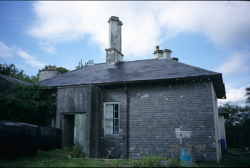 AdelphiHouse · 1255 yd
 Inchiquin IslandIslet · 1.3 mi
 Rock IslandIsland · 1.3 mi
.jpg/250px-Church_of_Rath_Blaithmaic_sheela-na-gig_(upside_down).jpg "Photo: The Banner, Wikimedia Commons · CC BY-SA 3.0") Sheela-na-gig in RathSheela-na-gig · 1.4 mi
Sheela-na-gig in RathSheela-na-gig · 1.4 mi Inchiquin Castle (in ruins)Castle, tower house · 1.5 mi
 O'Dea CastleCastle · 2.2 mi
 Sheela-na-gig in KillinaboySheela-na-gig · 2.4 mi
 European ash3.2 mi
 Burren National ParkVisitor information · 4.8 mi
 Burren national parkVisitor information · 4.9 mi
 Burren Centre KilfenoraVisitor information · 6.2 mi
More archaeology and monuments in County Clare · All of County Clare
What do you know about this place?