What is recorded here
On rock outcrop at the edge of a steep precipice which falls sharply to the S and W, overlooking a valley. Bawn associated with house of sixteenth century date (TS081-041001-). The Civil Survey (1654-6) describes Roosca castle in 1640 as 'an old stone house coverred with thatch within a bawne' owned by Theobald Butler…
Read the whole record
From the National Monuments Service (Archaeological Survey of Ireland) record TS081-041002
Places near here
Photo credits
- Maker not stated on source page, www.pinterest.com
- National Inventory of Architectural Heritage
- Maker not stated on source page, ca.pinterest.com
- Algirdas at Lithuanian Wikipedia, Wikimedia Commons · Public domain
- Maker not stated on source page, www.irishmirror.ie
- Maker not stated on source page, www.dreamstime.com
- Maker not stated on source page, www.travelmanagers.com.au
- Miguel Angel Masegosa Martínez, Wikimedia Commons · CC BY 2.0
 Roosca Castle (in ruins)House, 16th century · 18 yd
Explorer Tom Roosca Castle sits on a cliff edge, ready to drop the next place that replaces it off the precipice. It was built by…
 Thonoge HouseHouse · 418 yd
Explorer Tom Thonoge House is built in two separate phases, which means it has the attention span of a goldfish. One side is old…
 Church in KillinureChurch · 1219 yd
Explorer Tom Church in Killinure is invisible, which is perfect for winning a county fair prize for best hidden object. The yew tree…
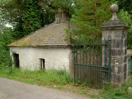 Ballybrada HouseDemesne walls/gates/railings · 1304 yd
Explorer Tom Ballybrada House demesne walls are the rabbits’ favorite playground, and they think the gates are just suggestions. The…
 Ballydrinan Old GraveyardGraveyard · 1472 yd
Explorer Tom Locals swear by a superstition at Ballydrinan Old Graveyard that says if you sneeze, a ghost owes you a favour. They’ve…
 Fairy fort / earthen ringfort in Ballygarrane (tubbrid Par.)Fairy fort / earthen ringfort · 1.3 mi
Explorer Tom Fairy fort / earthen ringfort in Ballygarrane thinks modern buildings are all flash and no substance, so it’s hiding…
 Pedunculate Oak1.4 mi
Explorer Tom Pedunculate Oak in County Tipperary was planted by a builder who was really thinking about lunch rather than the soil…
 Graveyard in Kilcommon More (north)Graveyard · 1.9 mi
Explorer Tom Graveyard in Kilcommon More was lost because a priest bet his church to a Swiss cottage owner, who then paved over the…
 Holy well in KilcoranHoly well · 3.0 mi
Explorer Tom Holy well in Kilcoran nearly got famous when a tourist mistook it for a spa and charged ten pounds a drop. It dried up…
 CastleCastle, unclassified · 3.2 mi
Explorer Tom Castle in Garryroe is playing hide-and-seek across three townlands because it can't make up its mind where to live. It…
 Site of Cloheenafishoge CastleCastle, unclassified · 4.1 mi
Explorer Tom Site of Cloheenafishoge Castle would complain to the council about its lack of funding and the terrible quality of the…
 Sweet Chestnut5.5 mi
Explorer Tom This Sweet Chestnut in County Tipperary is the centre of a feud between two families over who owns the best view from…
More castles and forts in County Tipperary · All of County Tipperary

What do you know about this place?Tap to add a comment or ask a question