What is recorded here
On a natural knoll in low-lying reclaimed bogland on the E shore of Lough Atalia. A possible enclosure (NNE-SSW c. 140m; WSW-ENE c. 123m), roughly subrectangular in plan, proved on inspection to be a field boundary which is visible NE through S to N and survives as a robbed-out wall (H 0.6m; Wth 0field .3-0.4m) from N to NE. The wall (H at W 0.8m) is composed of a combination of single large boulders (T c. 0.5m) and tumbled down sections of boulders two to three courses high; it is heavily overgrown with brambles and briars. Only one wall-face is evident and the wall appears to revet the knoll. The is no evidence of an entrance gap and the interior rises towards the centre and is subdivided by a number of field walls. A number of large freight containers were being stored in the NW section on inspection. A pathway leading from the roadway to the E runs through the site and access a modern slipway at NNW. Cartographic evidence indicates that the area around the enclosing wall was subject to flooding and so it is likely that the wall simply delimits higher ground. The following images have been uploaded:
GA094-117----_01.jpg View from W
GA094-117----_02.jpg View from SW
GA094-117----_03.jpg View from SE
Compiled by: Olive Alcock
Date of upload: 12 July 2023
On a natural knoll in low-lying reclaimed bogland on the E shore of Lough Atalia. A possible enclosure (NNE-SSW c. 140m; WSW-ENE c. 123m), roughly subrectangular in plan, proved on inspection to be a field boundary which is visible NE through S to N and survives as a robbed-out wall (H 0.6m; Wth 0field .3-0.4m) from N to NE. The wall (H at W 0.8m) is composed of a combination of single large boulders (T c. 0.5m)…
From the National Monuments Service (Archaeological Survey of Ireland) record GA094-117
The monument record does not grant public access. Check the route and ask the landowner before entering private land.
- What survives
- Recorded monument
Places near here
Photo credits
- National Inventory of Architectural Heritage
- Maker shown on the Wikimedia Commons file page · Public domain
- Donal Mac Coitir, Wikimedia Commons · CC BY 4.0
- Robert Linsdell from St. Andrews, Canada, Wikimedia Commons · CC BY 2.0
- N Chadwick, Geograph · CC BY-SA 2.0
- A.-K. D., Wikimedia Commons · CC BY-SA 4.0
- Berthold Werner, Wikimedia Commons · CC BY-SA 4.0
- Gareth James, Geograph · CC BY-SA 2.0
- Shane.Halloran at English Wikipedia, Wikimedia Commons · Public domain
- Sarah777, Wikimedia Commons · Public domain
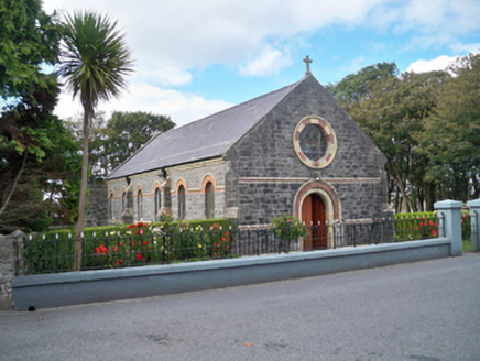 Dún Uí MhaoilíosaChurch/chapel · 442 yd
 Dún Uí MhaoilíosaOfficers' mess · 476 yd
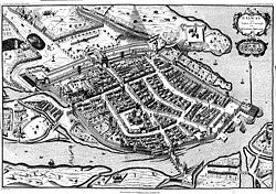 Siege of GalwaySiege · 523 yd
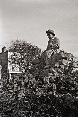 Padraic O'Conaire StatueMonument · 1038 yd
_(26501338721).jpg/250px-The_Browne_Doorway,_Eyre_Square,_Galway_(506257)_(26501338721).jpg "Photo: Robert Linsdell from St. Andrews, Canada, Wikimedia Commons · CC BY 2.0") The Browne DoorwayMonument · 1069 yd
The Browne DoorwayMonument · 1069 yd Browne DoorwayVisitor information · 1070 yd
 Mechanics InstituteMemorial · 1245 yd
 Lynch's CastleCastle · 1266 yd
 Ballyloughane BeachBeach / strand · 1292 yd
 Hall of the Red EarlMemorial · 1412 yd
 Galway City MuseumMuseum · 1452 yd
 Spanish ArchHeritage attraction · 1486 yd
More archaeology and monuments in County Galway · All of County Galway
What do you know about this place?