
Places near here
Photo credits
- National Inventory of Architectural Heritage
- Willow, Wikimedia Commons · CC BY 2.5
- Mike Searle, Wikimedia Commons · CC BY-SA 2.0
- Christian Pirkl, Wikimedia Commons · CC BY-SA 3.0 at
- Nigel Thompson, Wikimedia Commons · CC BY-SA 2.0
Explorer Tom Enclosure in Knocknagulshy holds the official world record for being the most boring sub-rectangular shape on a ridge in Mayo. It’s been sitting there since forever, just waiting for someone to notice how unremarkable it is. Tell it a joke, it's been a long time since anyone did.
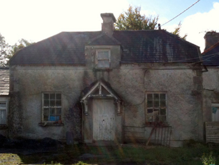 Creagh HouseSteward's house · 766 yd
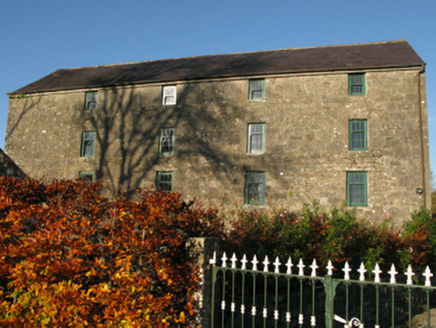 mill (water)1458 ydRat IslandIslet · 1.5 miCastle Hag RockIslet · 1.6 mi
 European ash1.7 mi
Explorer Tom European ash is what the builder was really thinking when he decided to chop down the perfect straight timber for the roof beams. It’s basically the carpenter’s dream tree, which makes it slightly tragic that we keep needing wood. Take the long way round, it deserves the effort.
LabbadermotCave · 2.4 mi Cloonagashel CastleCastle · 3.6 mi
 Sycamore3.6 mi
Explorer Tom Sycamore’s least favourite visitor is definitely the guy who tries to climb it in his dress shoes and complains about the leaves. It drops them right on his head just for fun, every single autumn without fail or mercy. It's the kind of place that makes a dull Tuesday interesting.
 Loughmask CastleCastle · 4.0 mi
 Neale CemeteryCemetery · 4.3 mi
 The Gods of the Neale MonumentMonument · 4.6 mi
More archaeology and monuments in County Mayo · All of County Mayo

What do you know about this place?Tap to add a comment or ask a question