Places near here
Photo credits
- Charles W Glynn, Wikimedia Commons · CC BY-SA 2.0
- Gordon Hatton, Geograph · CC BY-SA 2.0
- Richard cattel, Geograph · CC BY-SA 2.0
- Eddylandzaat, Wikimedia Commons · CC BY-SA 3.0 nl
- The Banner, Wikimedia Commons · CC BY-SA 3.0
- Kmcnamee, Wikimedia Commons · CC BY-SA 4.0
- Simon Huguet, Wikimedia Commons · CC BY-SA 2.0
- Roger Diel, Geograph · CC BY-SA 2.0
- Chris, Geograph · CC BY-SA 2.0
- National Inventory of Architectural Heritage
- Simon Huguet, Wikimedia Commons
- Charles W Glynn, Geograph · CC BY-SA 2.0
 Mutton IslandIsland · 703 yd
Explorer Tom Mutton Island off Clare really does have sheep, so I cannot even claim the name is one of my inventions. The island…
 Lurga PointHeadland · 1552 yd
Explorer Tom Lurga Point is getting picked on by the wind because it stands so close to Mutton Island, which makes it look like a…
 Seafield North BeachBeach / strand · 1.3 mi
Explorer Tom Seafield North Beach sits by the pier southwest of Quilty, a Clare shore made for a gentle wander and a long look at…
 Tromra CastleRuins · 1.8 mi
Explorer Tom Tromra Castle is actually run by a very serious border collie who guards the perimeter with intense focus. It barks at…
 Catholic Church of Our Lady Star of the SeaChurch/chapel · 2.2 mi
Explorer Tom Catholic Church of Our Lady Star of the Sea in Quilty West is glowing like it’s trying to attract ships that aren’t…
 Kilmurry Ibrickane GAA pitchGAA ground · 2.5 mi
 Emlagh PointHeadland · 2.5 mi
Explorer Tom Emlagh Point would take its lotto win, buy a massive pair of binoculars, and just stare at the bay until the fish get…
 Caherrush Castle (in Ruins)Castle, tower house · 2.9 mi
Explorer Tom Caherrush Castle is probably being run by a fox who thinks he’s the landlord. It’s a tower house that’s seen better…
 Spanish PointHeadland · 3.7 mi
Explorer Tom Spanish Point has been hiding a scandal involving a Spanish galleon that sank with a crate of very rude postcards…
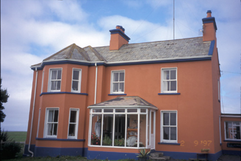 Atlantic LodgeCoastguard station · 3.8 mi
Explorer Tom Atlantic Lodge in Breaffy South was a coastguard station until it decided to be a private house instead. The name makes…
 Spanish Point BeachVisitor attraction · 3.8 mi
Explorer Tom Spanish Point Beach curves around Mal Bay in west Clare, and Tom has decided the Atlantic is putting on a surf show…
 Doughmore BeachBeach / strand · 3.8 mi
Explorer Tom Doughmore Beach near Doonbeg is not interested in being a dainty little cove. Its sand runs for about four and a half…
More archaeology and monuments in County Clare · All of County Clare

What do you know about this place?Tap to add a comment or ask a question