
What is recorded here
From the National Monuments Service (Archaeological Survey of Ireland) record CL002-003001
Places near here
Photo credits
- Maker not stated on source page, commons.wikimedia.org
- Maker not stated on source page, www.tripadvisor.com
- National Inventory of Architectural Heritage
- Maker not stated on source page, www.pinterest.com
- Danny Burke, Wikimedia Commons · CC BY-SA 2.5
- Maker not stated on source page, www.alamy.com
- Maker not stated on source page, www.tripadvisor.ie
- John M, Geograph · CC BY-SA 2.0
- Suzanne Mischyshyn, Geograph · CC BY-SA 2.0
- Maker not stated on source page, www.galwaytourism.ie
- The original uploader was Rwxrwxrwx at English Wikipedia ., Wikimedia Commons · CC BY-SA 3.0
 CairnCairn, unclassified · 1136 yd
Explorer Tom Cairn in Aghaglinny North has no idea where it actually is, which is embarrassing for a mound of stones. It would cope…
 Caher Bridge GardenGarden · 1162 yd
Explorer Tom Caher Bridge Garden has very strong opinions on modern buildings, particularly those that use glass, which it describes…
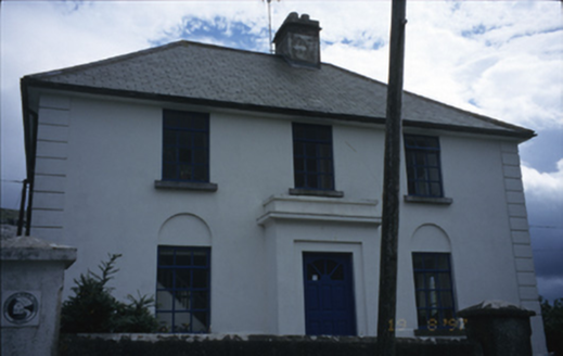 garda station/constabulary barracks1.3 mi
Explorer Tom Garda station in Fanore More is now a hostel, so the ghosts have to share a bathroom with backpackers. I bet a poet…
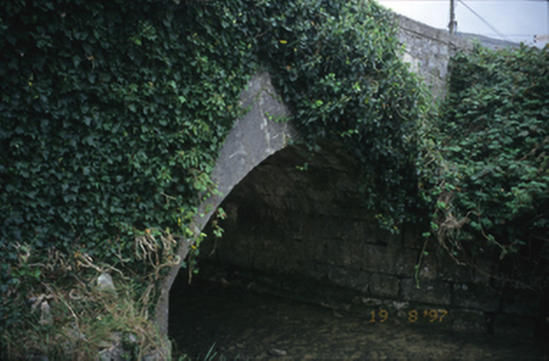 Fanore BridgeBridge · 1.4 mi
Explorer Tom Fanore Bridge in Fanore More spans the river like it owns the place, which it probably does. I bet there's a biscuit…
 Holy well in Formoyle WestHoly well · 1.5 mi
Explorer Tom Holy well in Formoyle West is invisible at ground level, which is great for keeping secrets but terrible for finding it…
 CaherdoonfergusFairy fort / stone ringfort · 1.5 mi
Explorer Tom Caherdoonfergus sits above Black Head like it owns the place, even if nobody knows who built it. Tell me if the fairy…
 Bullaun stone in Formoyle WestBullaun stone · 1.6 mi
Explorer Tom Bullaun stone in Formoyle West had a massive feud with the rain until it disappeared in 1987, which feels like a very…
 Fanore Beach - Burren GeositeVisitor information · 1.9 mi
Explorer Tom Fanore Beach - Burren Geosite is having a total identity crisis, posting selfies that are half sand and half ancient…
 Fanore BeachVisitor information · 1.9 mi
Explorer Tom Fanore Beach is actually run by a dog who barks at anyone who doesn’t bring enough treats, so make sure you’re prepared…
 Black HeadHeadland · 2.0 mi
Explorer Tom Black Head would bring a very heavy coat to any party because it thinks it’s always cold and slightly damp inside. It’s…
 Lighthouse CaveCave · 2.0 mi
Explorer Tom Lighthouse Cave in Murrooghtoohy North has a prophecy about becoming the world's most famous cave, but it hasn't…
 AilladieCliff · 6.1 mi
Explorer Tom Ailladie is eight hundred metres of Clare limestone that makes climbers grin and makes me check where my feet are. The…
More archaeology and monuments in County Clare · All of County Clare

What do you know about this place?Tap to add a comment or ask a question