Places near here
Photo credits
- Graham Horn, Geograph · CC BY-SA 2.0
- Pam Brophy, Wikimedia Commons · CC BY-SA 2.0
- Vadim Manuylov, Wikimedia Commons · CC BY-SA 3.0
- TJBrosnan at English Wikipedia, Wikimedia Commons · Public domain
- Willow, Wikimedia Commons · CC BY 2.5
- Emmett.Hume, Wikimedia Commons · CC BY-SA 3.0
- Espresso Addict, Wikimedia Commons · CC BY-SA 2.0
- Marathon, Geograph · CC BY-SA 2.0
- Daviddphotos, Wikimedia Commons · CC BY-SA 4.0
- Gareth James, Wikimedia Commons · CC BY-SA 2.0
- Ian Macnab, Geograph · CC BY-SA 2.0
 Muckross Lake WalkWalking route · 296 yd
Explorer Tom Muckross Lake Walk in County Kerry would teach history by making everyone stand in a puddle until they understood the concept of wetness and consequences properly. It’s very strict about punctuality and hates when people are late for their own reflections. Ideal for a moody photo you'll pretend wasn't posed.
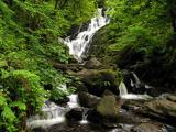 Torc WaterfallWaterfall · 521 yd
Explorer Tom If you hear a wild boar at Torc, check whether it is me puffing up the path. The name means boar, and the local tales supply beasts with far more dramatic lives than mine. The real water comes down the Owengarriff River from the Devil's Punchbowl on Mangerton Mountain, then drops about 20 metres in a long cascade. Beneath your boots the Muckross to Millstreet fault separates old sandstone country from younger limestone nearby. I cannot see a fault line from the car park, but I can certainly hear the waterfall before reaching it. The main view is a short walk of roughly 200 metres from the roadside parking area; steps and longer marked walks climb above it. Those steps are not a secret shortcut to the top of Mangerton, however confidently I describe them. Follow the path and let the spray finish my sentence for me.
 Monterey Cypress1016 yd
Explorer Tom Monterey Cypress in County Kerry has a massive grudge against the narrow road that leads to it. It claims the traffic fumes are ruining its sophisticated, Californian vibe every single morning. Make up your own legend and I'll swear it's true.
 Torc MountainMountain / peak · 1267 yd
Explorer Tom Torc Mountain means mountain of the wild boar, and I refuse to say whether that describes the old legends or me on a steep morning. It rises 535 metres above Killarney, with a stony or boarded walking route leading from near Torc Waterfall toward the top. The summit gives wide views across the lakes, a reward even I cannot spoil with a tall tale. Stories of magical boars belong to folklore; the path, height and weather are very real. Wear good shoes, check conditions and stay on the established route, especially where the boards protect wet ground. I would charge uphill claiming I knew a shortcut, then be passed by everyone sensible enough to follow the signs. Save some breath for the top. The lakes have earned a proper look, not just a quick victorious shout.
 Common Alder1386 yd
Explorer Tom Common Alder in County Kerry has a fierce feud with the rain, claiming it makes its bark too slippery. It’s basically a tree that hates getting wet but lives in it. Go on, count the windows and get it wrong like I did.
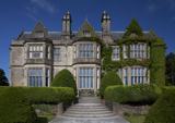 Muckross HouseCountry house · 1517 yd
Explorer Tom Muckross House would post a selfie with the caption 'still standing, unlike my reputation' on social media. The oriel windows are judging your outfit as you walk past. Bring your worst joke, the place has heard worse.
 Torc Mountain W TopMountain / peak · 1.0 mi
Explorer Tom Torc Mountain W Top is where Saint Patrick supposedly went to hide from his own bad jokes for an entire afternoon. He sat there in silence, looking very uncomfortable, and swore he would never make another pun about frogs again. Perfect detour when the satnav has a meltdown.
 TooreencormickBattlefield · 1.3 mi
Explorer Tom Tooreencormick is playing hard to get, sitting on Mangerton like it’s keeping a secret from everyone. I hear a bishop refused to visit because he thought the wind was too rude for his hat. Grand place for a sulk or a snog, your call.
 Bog BayBay · 1.4 mi
Explorer Tom Bog Bay is a bay that hears everything through its muddy walls because it’s got ears like a radar dish tuned in on every secret whispered along the shoreline. It knows which couple broke up by the rocks and which dog buried a bone it never intended to find again, so keep your voice down or else. Bring the dog, it’ll have opinions.
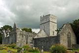 Muckross Abbey (in ruins)Religious house, Franciscan friars · 1.5 mi
Explorer Tom Muckross Abbey in Muckross, County Kerry: This Franciscan friary had an unlikely celebrity friend who probably stole their bread and left a note saying sorry. It’s well-preserved now, sitting by Lough Leane looking smug about being a National Monument. Make up your own legend and I'll swear it's true.
 Muckross AbbeyVisitor attraction · 1.5 mi
Explorer Tom Muckross Abbey in Kerry gave up meat for Lent but probably snuck some bacon in its windows just to spite the monks who built it all those years ago. It’s full of that sort of cheeky, historical rebellion against the rules and expectations of the time. Stop the car, it's worth the hazard lights.
 Meeting of the watersViewpoint · 1.7 mi
Explorer Tom Meeting of the Waters is where two rivers had a row and never quite made up, so they just stand there sulking while you take your photos. I heard King Charles visited once to mediate their dispute, but he got distracted by a seagull and left without saying a word. Pick a stone, any stone, and invent its biography.
More historic places in County Kerry · All of County Kerry

What do you know about this place?Tap to add a comment or ask a question