
Places near here
Photo credits
- Kenneth Allen, Geograph · CC BY-SA 2.0
- National Inventory of Architectural Heritage
- Kenneth Allen, Wikimedia Commons · CC BY-SA 2.0
- Gerard Lovett from ireland, Wikimedia Commons · CC BY 2.0
- National Library of Ireland on The Commons; photograph by Thomas H. Mason, Wikimedia Commons · No known copyright restrictions
- Anne Burgess, Wikimedia Commons · CC BY-SA 2.0
- N Chadwick, Geograph · CC BY-SA 2.0
- Anne Burgess, Geograph · CC BY-SA 2.0
 The Rainbow BallroomTurkish baths, building misc · 2.1 mi
Explorer Tom The Rainbow Ballroom in Brockagh Lower would survive Big Brother by just standing there and judging everyone’s dance…
 Glenfarne Railway StationStation master's house · 2.3 mi
Explorer Tom Station master's house in Brockagh Lower is doing its best royal impression. Legend says a king visited for tea and…
 TobermurvyHoly well · 2.8 mi
Explorer Tom Tobermurvy in Derrynalester holds patterns in August, which means the local sheep probably have opinions on whether the…
 TobermurrySpring · 2.8 mi
Explorer Tom Tobermurry in County Cavan lost a bet to a priest who swore he’d never drink from it again. Now he’s stuck watering his…
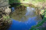 Shannon PotSpring · 3.5 mi
Explorer Tom The Shannon begins with a pool in Cavan that looks far too modest for Ireland's longest river. Shannon Pot is about…
Síonnan and the Salmon: Shannon PotLegend location · 3.5 miExplorer Tom Síonnan and the Salmon: Shannon Pot has a curious woman chasing the Salmon of Wisdom and a pool that responds by…
 IndicatedFairy fort / stone ringfort · 3.6 mi
Explorer Tom Fairy fort or stone ringfort in Moneygashel has seven steps built into the wall and blocked-up internal staircases…
 Lough MacNean WalkWalking route · 3.6 mi
Explorer Tom Lough MacNean Walk in County Leitrim would order a double chipper with vinegar and absolutely no apologies. It’s a path…
 Cavan BurrenVisitor attraction · 4.5 mi
Explorer Tom Cavan Burren is rocky, crumbly, and looks like someone dropped a giant bag of gravel and left. The first owner probably…
 BurrenMountain / peak · 4.5 mi
Explorer Tom If Burren walked into a chipper, it would order the lot with extra vinegar and complain that the fries weren't crispy…
 Rosscorkey IslandIsland · 4.5 mi
Explorer Tom Rosscorkey Island has a ghost that is far too lazy to haunt properly, preferring to nap in the tall grass instead of…
 Boulder GraveyardArchaeological place · 4.7 mi
Explorer Tom Boulder Graveyard is absolutely showing off its massive stones and thinks it deserves a proper housewarming party for…
More archaeology and monuments in County Leitrim · All of County Leitrim

What do you know about this place?Tap to add a comment or ask a question