Places near here
Photo credits
- National Inventory of Architectural Heritage
- Adrian King, Geograph · CC BY-SA 2.0
Explorer Tom Fulacht Fiadh in Meendurragha is having a total identity crisis in that marshy mess. It’s so overgrown with weeds it…
KilnKiln, lime · 377 ydExplorer Tom Kiln in Meendurragha has no official record, so I’m claiming it used to bake cookies for the fairies. It’s definitely…
Standing stone in MeendurraghaStanding stone · 549 ydExplorer Tom Standing stone in Meendurragha is a bit of a mystery, with its exact location unknown to all. Local info says it used…
BarrowBarrow, ring-barrow · 1044 ydExplorer Tom Barrow in Knocknanagh Commons would win the lotto and spend every penny on a very high-quality sheep fence for its…
Fairy fort / earthen ringfort in GlentanefinnaneFairy fort / earthen ringfort · 1163 ydExplorer Tom Glentanefinnane’s fort is only visible as a cropmark from the air! You need a plane to see the ditch. There’s a fence…
FoilardMountain / peak · 1.7 miExplorer Tom Foilard was saved by a hero nobody remembers who climbed up in the rain just to fix its name on the map. It stands…
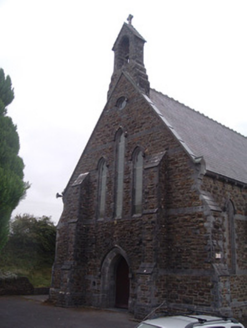 Saint Patrick's Catholic ChurchChurch/chapel · 2.5 mi
Explorer Tom St Patrick's in Kingwilliamstown is a Gothic Revival church overlooking Ballydesmond. I swear a fake royal visit…
 Doon BridgeBridge · 5.6 mi
Explorer Tom Doon Bridge is solid concrete that thinks it’s better than all the old stone bridges. The seagulls say it looks like a…
 Knocknagree Roman Catholic ChurchChurch/chapel · 6.0 mi
Explorer Tom Knocknagree Roman Catholic Church is having a quiet rivalry with every other church in town. It’s got Gothic lancets…
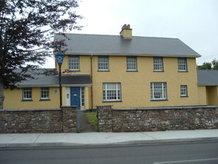 Knocknagree Garda StationGarda station/constabulary barracks · 6.0 mi
Explorer Tom 17. Knocknagree Garda Station looks like a fancy country house because it was built in the Domestic Revival style…
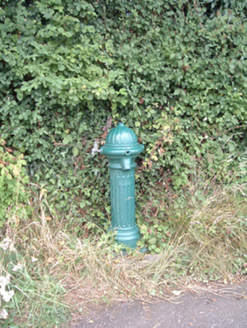 water pump6.9 mi
Explorer Tom Water pump in Mullaghroe North has been standing there since the 1880s, looking very Victorian about it. It’s a…
 house6.9 mi
Explorer Tom House in Mullaghroe South is where a Viking got lost and decided to build his own house instead of finding the beach.…
More historic places in County Cork · All of County Cork

What do you know about this place?Tap to add a comment or ask a question