What is recorded here
On a NNW-facing slope in undulating terrain, Lyre Glen runs c. 20-30m to the W. A roughly circular ringfort (diam. 38.5m N-S; E-W based on OS 6-inch map is c. 30m) enclosed by an earthen bank (Wth 1.8m; int. H 1m; ext. H 0.2m) with a high stone content and evidence of a stone revettment. In the W quadrant the bank is reduced to scarp (H c. 3m). The monument is known locally as the 'Lis'. The ringfort is heavily overgrown with scrub both on the banks and in the interior. There is a gap in the bank in the SSW quadrant.
On a NNW-facing slope in undulating terrain, Lyre Glen runs c. 20-30m to the W. A roughly circular ringfort (diam. 38.5m N-S; E-W based on OS 6-inch map is c. 30m) enclosed by an earthen bank (Wth 1.8m; int. H 1m; ext. H 0.2m) with a high stone content and evidence of a stone revettment. In the W quadrant the bank is reduced to scarp (H c. 3m). The monument is known locally as the 'Lis'. The ringfort is heavily…
From the National Monuments Service (Archaeological Survey of Ireland) record TS073-018
The monument record does not grant public access. Check the route and ask the landowner before entering private land.
- What survives
- Recorded monument
Places near here
Photo credits
- National Inventory of Architectural Heritage
- Colin Park, Geograph · CC BY-SA 2.0
- kevin higgins, Geograph · CC BY-SA 2.0
- N Chadwick, Wikimedia Commons · CC BY-SA 2.0
- N Chadwick, Geograph · CC BY-SA 2.0
- Seighean ( talk ), Wikimedia Commons · Public domain
 Dungrot BridgeBridge · 972 yd
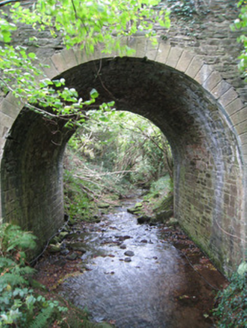 Longford BridgeBridge · 1010 ydSite of Dungrot CastleCastle, unclassified · 1030 ydCairnCairn, unclassified · 1242 ydGiant's Rock - Rock of AglaishNamed rock · 1440 yd
 SlievecushnabinniaMountain / peak · 1.6 mi
 CarrignabinniaMountain / peak · 1.6 mi
 Lough CurraWalking route · 1.7 mi
 Glen of AherlowViewpoint · 3.8 mi
 Christ the KingViewpoint · 3.9 mi
 The RockViewpoint · 4.6 mi
 Glengarra WoodForest · 6.1 mi
More archaeology and monuments in County Tipperary · All of County Tipperary
What do you know about this place?