What is recorded here
The parish church of Loughcrew (ME015-027----) is within a rectangular graveyard (dims c. 54m E-W; c. 43-50m N-S) defined by masonry walls (H c. 3m) and, according to Dopping’s Visitation (1682-5) the church and chancel were repaired and the graveyard was walled at that time (Ellison 1975, 10).
Compiled by: Michael Moore
Date of upload: 26 May, 2014
The monument record does not grant public access. Check the route and ask the landowner before entering private land.
- What survives
- Recorded monument
Places near here
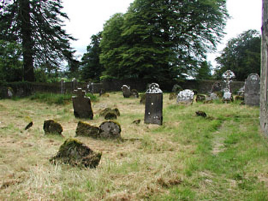 graveyard/cemeterygraveyard/cemetery · 2 yd
_-_geograph.org.uk_-_7213807.jpg?width=1280) Church (in Ruins)Church · 9 yd
Church (in Ruins)Church · 9 yd Common LimeCommon Lime · 60 yd
 European YewEuropean Yew · 78 yd
 Zip WireHeritage attraction · 194 yd
 MoatCastle, motte · 243 yd
 RathFairy fort / earthen ringfort · 683 yd
 Fairy fort / earthen ringfort in LoughcrewFairy fort / earthen ringfort · 1045 yd
 C11Named rock · 1365 yd
 Carnbane WestMountain / peak · 1369 yd
 LoughcrewMegalithic tomb cemetery · 1509 yd
 CastleCastle, unclassified · 1.4 mi