
What is recorded here
Drumsawry Castle is a castle in Drumsawry. The castle is no longer a complete building, but it is still a place where people lived, worked or passed through. What is missing has not stopped the castle from existing.
A castle at Drumsawry Glebe (63) in Oldcastle parish is depicted on the Down Survey (1656-8) barony and parish maps (http://downsurvey.tcd.ie/) but as it had once been owned by the abbey of Fore (WM004-035010-) it was not recorded in the Civil Survey (1654-6) (Simington 1940, 268-70). It is depicted as a ruin on Taylor and Skinner's map (1778, 57) and on MS map 1399 (11) in NLI, made in 1778. It is depicted as a roofless structure on the 1836 ed. of the OS 6-inch map but is not named. This is a cairn of stones with parts of the N and S walls standing from a structure (ext. dims 9.4m plus E-W; 6m plus N-S). The church (ME009-042002-) is 10m to the S. (O’Connell 1965, 174-5)
Archaeological testing (05E1393) by C. Duffy on a plot (dims c. 100m E-W c. 30m N-S) c. 200m to the SSW produced no related material (excavations.ie 2005:1174; 2006:1522).
The above description is derived from the published 'Archaeological Inventory of County Meath' (Dublin: Stationery Office, 1987). In certain instances the entries have been revised and updated in the light of recent research.
Compiled by: Michael Moore
Date of revision: 8 June 2016
Amended: 18 February 2021
The castle at Drumsawry Glebe was once owned by Fore Abbey and appears on the Down Survey maps of 1656–58; its importance lies in its historical association with the medieval Cistercian abbey, reflecting the abbey's extensive landholdings in the region.
The monument record does not grant public access. Check the route and ask the landowner before entering private land.
- What survives
- Recorded monument
Places near here
 indicatedChurch · 23 yd
 Enclosure in Ballinvally,drumsawry OR SummerbankEnclosure · 860 yd
 Enclosure in BallinvallyEnclosure · 892 yd
 C11Named rock · 1277 yd
 Carnbane WestMountain / peak · 1306 yd
 LoughcrewMegalithic tomb cemetery · 1518 yd
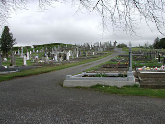 graveyard/cemeterygraveyard/cemetery · 1.2 mi
 Loughcrew Megalithic TombsHeritage attraction · 1.2 mi
 Slieve Na CalliaghMountain / peak · 1.2 mi
 Common LimeCommon Lime · 1.4 mi
 European YewEuropean Yew · 1.4 mi
 MoatCastle, motte · 1.4 mi
Other information
Photo: Credit not shown in the picture search · Rights wording not checked; contact us if this picture should be removed