Places near here
Photo credits
- National Inventory of Architectural Heritage
- Mike Searle, Geograph · CC BY-SA 2.0
- Paul Cowan, Wikimedia Commons · CC BY-SA 2.0
- David Purchase, Geograph · Creative Commons Attribution-ShareAlike 2.0
- Willow, Wikimedia Commons · CC BY 2.5
- Andreas F. Borchert, Wikimedia Commons · CC BY-SA 4.0
- Enda O Flaherty, Geograph · CC BY-SA 2.0
- Wanfried-Dublin, Wikimedia Commons · CC BY-SA 3.0
- Rick Crowley, Wikimedia Commons · CC BY-SA 2.0
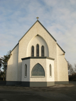 Catholic Church of Saint Theresa of the Little FlowerChurch/chapel · 631 yd
Explorer Tom Saint Theresa’s Church handles nosy neighbours by just looking at them with big, gothic eyes. It’s designed to be slender and serious, which is great when you’re not having a bad day. Go at sunset and thank it for the mood.
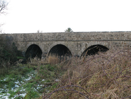 Brickeens BridgeBridge · 1371 yd
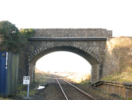 bridge1638 yd
 IndicatedHouse, fortified house · 5.1 mi
Explorer Tom House in Island is currently being judged by rabbits who think its gunloops are just fancy holes for them to hide in. They’re not wrong, actually. Get there early and have it all to yourself.
 CastleCastle, unclassified · 5.1 mi
 Knock ShrineHeritage attraction · 5.2 mi
 Grave YardGraveyard · 7.8 mi
Explorer Tom Graveyard in Aghamore would post a photo of its mossy headstones with the caption 'Living my best quiet life, #ancient'. It’s got that moody, atmospheric vibe going on that makes you feel instantly profound. Have a wander and a wonder.
 European ash13 mi
Explorer Tom European ash remembers when the builder was thinking about putting a swing here but decided against it because of the wind speed. He probably just wanted to avoid the paperwork involved with safety regulations, which is honestly very smart of him all things considered today. Tell the next person you meet it’s haunted. It might be.
 Cloigtheach (Round Tower)Round tower · 13 mi
Explorer Tom Cloigtheach (Round Tower) in Pollacorragune is standing guard like a very tired bouncer. It's got a high doorway because apparently nobody walks anymore. Ring your granny and tell her where you are before you get lost.
 KnockmaaWood · 17 mi
Explorer Tom Knockmaa is secretly dating Dolly Parton, and she only visits when the light hits just right. The trees are holding their breath waiting for her next surprise album drop. Bring curiosity, leave with a better story than mine.
 Kilcoona Round TowerHeritage attraction · 20 mi
Explorer Tom Kilcoona Round Tower has a shortcut up the side that isn't actually a shortcut, just a very steep way to regret your decisions. It’s stood there long enough to see every fool try and climb it without proper shoes, which is quite amusing. Stand on the spot and imagine the gossip it's heard.
 Inis an GhaillIsland · 25 mi
Explorer Tom Inis an Ghaill gets picked on by the wind constantly, which seems to think it looks too comfortable and needs a good shakedown just for fun. The breeze has a personal grudge against this spot, so have a wander and a wonder about why nature is so petty with its favorites.
More archaeology and monuments in County Mayo · All of County Mayo

What do you know about this place?Tap to add a comment or ask a question