Places near here
Photo credits
- National Inventory of Architectural Heritage
- Colin Park, Wikimedia Commons · CC BY-SA 2.0
- MarieDub, Wikimedia Commons · CC BY-SA 4.0
- Pearse MacIntyre, Wikimedia Commons · CC BY-SA 4.0
- John M, Geograph · CC BY-SA 2.0
- Einaz80, Wikimedia Commons · CC BY-SA 4.0
- Dennis Reynolds, Geograph · CC BY-SA 2.0
- P L Chadwick, Geograph · CC BY-SA 2.0
- Michael Murtagh, Geograph · CC BY-SA 2.0
- Ardfern, Wikimedia Commons · CC BY-SA 3.0
- Michael Earnshaw, Geograph · CC BY-SA 2.0
 Teachín TessieHouse · 1.4 mi
Explorer Tom Teachín Tessie has a rounded thatched roof that looks like it’s just dozing off in the Glencolumbkille wind. Built around 1860, I picture the house tucking its chin into its arms to keep warm, while the ropes over its back hold tight so it doesn’t roll away.
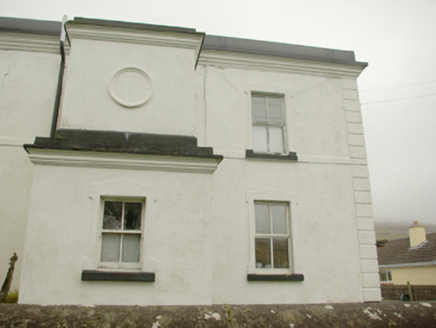 lighthouse keeper's house1.4 mi
Explorer Tom Lighthouse keeper's house in An Gaineamh Agus An Curraoin looks like a spaceship that crashed into a field of sheep. I just picture the keepers in 1910 staring at their own reflection, wondering why it has no pointy roof.
 Farranmacbride Court TombCourt tomb · 1.5 mi
Explorer Tom Farranmacbride Court Tomb is a sprawling oval with chambers poking out like fingers from a stone glove. A sunken track cuts right through the middle, so half the cairn has been bulldozed into grassy nothing. It’s a bit ruined on one side, but those surviving gallery walls still hold their ground against the bog.
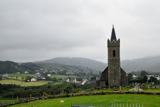 Glencolmcille Old GraveyardGraveyard · 1.5 mi
Explorer Tom Glencolmcille Old Graveyard holds two church stories: the modern church stands just north of an older church site, whose building was pulled down in 1828. I spotted a useful caution in the record too: earlier writers mentioned a circular enclosure, but the later survey saw no trace. One dot, several layers, and not all equally certain.
 Cross-inscribed pillar in An Caiseal (tc Málainn Bhig)Cross-inscribed pillar · 1.5 mi
Explorer Tom Cross-inscribed pillar in An Caiseal is keeping watch over a subcircular cairn on the rocky floor of Glencolumbkille. I reckon it’s like a very serious, slightly oversized lollipop that someone left behind for the hills to share. It’s a fantastic little puzzle to stare at and wonder what the quartered circle was actually trying to say.
 Biddy's PubPub · 1.7 mi
Explorer Tom Biddy's Pub sits at the crossroads in Glencolumcille, where the music stops and the shouting starts. It claims to be older than the stones outside, which is definitely a stretch but who’s checking? Stand still and listen, the wind tells it better than me.
 Glencolmcille Folk VillageMuseum · 2.3 mi
Explorer Tom Glencolmcille Folk Village lines up Donegal homes from the 18th, 19th and 20th centuries in replica cottages. I could walk from one period to another before my tea went cold, though the furniture would change on me at every door. It is a clever way to compare ordinary lives.
 CroaghstraleelMountain / peak · 3.0 mi
Explorer Tom Croaghstraleel in County Donegal is having a massive go at the council, claiming they’ve left its name half-spelled and it’s been filing noise complaints about the wind for decades. It says if you don’t fix the signage, it’ll grow another foot just to be cheeky, which is very likely given its mood. Have a look and decide if I was lying.
 John the miner'sPub · 4.5 mi
Explorer Tom John the miner’s in Carrick sounds like he dug up more than coal. It was previously just known as Central Bar, so keep one eye on the exit! Bring your worst joke, the place has heard worse.
 Slieve LeagueMountain / peak · 4.5 mi
Explorer Tom Donegal made a cliff so high even my bragging looks small. Slieve League lifts County Donegal 601 metres above the Atlantic, then appears to remember that it has no obligation to provide a gentle way down. Its Irish name means mountain of stone pillars, and the rock certainly knows how to stand to attention. Naturalist Robert Lloyd Praeger wrote about the narrow One Man's Path in 1937, praising it while warning that bad weather calls for a steady head. He also noticed alpine plants tucked into the high northern hollow, a quieter little treasure beside the enormous drop. If I say I'll race the Atlantic to the bottom, please confiscate my boots. Many people take in the cliffs from Bunglass viewpoint, reached by the narrow road out of Teelin; the last stretch needs patient driving and the walking ground can be exposed. There is no prize for pressing onto the ridge in wind or poor visibility. Stand where your feet are happy, look along that great wall of sea cliff, and let the Atlantic do the boasting for once.
 Rossan PointHeadland · 4.5 mi
Explorer Tom Rossan Point in County Donegal caused the whole parish to argue about whether it was actually a point or just a very ambitious hill that got promoted. The debate lasted three days and ended with everyone agreeing it was both, which is typical for this part of the world. Go at sunset and thank me later.
 Slieve League se TopMountain / peak · 4.6 mi
Explorer Tom Slieve League SE Top is recorded as a mountain / peak in County Donegal, featuring an almost flat summit area. It leads to the narrow arete known as One Man's Pass, so keep your footing steady and your nerves calm.
More archaeology and monuments in County Donegal · All of County Donegal

What do you know about this place?Tap to add a comment or ask a question