
What is recorded here
The fairy fort or earthen ringfort in Lavagh (leyny By.) is in County Sligo, Ireland. It occupies undulating pasture on a gentle south-facing slope as a D-shaped raised area measuring 25.5 metres from north-west to south-east. A scarp defines the straight north-west side and parts of the north and north-east, while an earthen bank borders the remaining sides. An external dry flat-bottomed fosse extends along the south-west and straight north-west edges.
In undulating pasture, on a gentle S-facing slope. A D-shaped raised area (dims. 25.5m NW-SE) defined by a scarp on both the straight NW side (L 30.5m NE-SW) and from N-NE and by an earthen bank (Wth 1.5m; int. H 0.2m; ext. H 2.2m) elsewhere. An external dry flat-bottomed fosse (Wth 8m; D 0.9m) is evident S-W and along the straight NW side.
The above description is derived from the published 'Archaeological Inventory of County Sligo' compiled by Ursula Egan, Elizabeth Byrne, Mary Sleeman with Sheila Ronan and Connie Murphy (Dublin Stationery Office, 2005).
Date of upload: 18 January 2008
The monument record does not grant public access. Check the route and ask the landowner before entering private land.
- What survives
- Recorded monument
Places near here
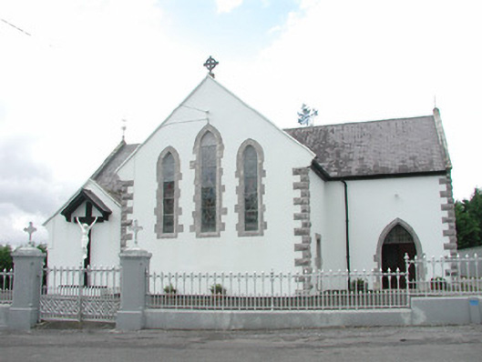 Catholic Church of the Sacred Heartchurch/chapel · 516 yd
 Abbey CourtReligious house, Franciscan friars · 1056 yd
 Indicated (1838).Fairy fort / earthen ringfort · 1459 yd
 Enclosure in Knocknashee CommonEnclosure · 1494 yd
 KnocknasheeMountain / peak · 1667 yd
 CastleCastle, unclassified · 1.2 mi
 Muckelty HillMountain / peak · 1.9 mi
 European ashEuropean ash · 3.5 mi
 ElderElder · 3.8 mi
 Castle (in Ruins)Castle, tower house · 4.5 mi
 The Turf Stack RockNamed rock · 5.2 mi
 Old Cave Burial GroundArchaeological place · 8.2 mi
Other information
Photo: Credit not shown in the picture search · Rights wording not checked; contact us if this picture should be removed