Places near here
Photo credits
- JuneGloom07, Wikimedia Commons · CC BY-SA 4.0
- The Banner, Wikimedia Commons · CC BY-SA 3.0
- Robert Bone, Geograph · CC BY-SA 2.0
- Paul Woods, Wikimedia Commons · CC BY 2.0
- Mac McCarron, Geograph · Creative Commons Attribution-ShareAlike 2.0
- Gordon Hatton, Geograph · Creative Commons Attribution-ShareAlike 2.0
- Mac McCarron, Geograph · CC BY-SA 2.0
- Drow69, Wikimedia Commons · CC BY-SA 3.0
- Mike Searle, Wikimedia Commons · Creative Commons Attribution-ShareAlike 2.0
- Bob Jones, Geograph · CC BY-SA 2.0
- Adrian King, Geograph · CC BY-SA 2.0
.jpg/250px-Father_Ted's_House_(2016).jpg "Photo: JuneGloom07, Wikimedia Commons · CC BY-SA 4.0") Glenquin HouseFarm house · 1505 yd
Glenquin HouseFarm house · 1505 ydExplorer Tom Glenquin House in Poulnalour was used for Father Ted, so it’s basically a shrine to bad puns. It would post a selfie on social media with the caption 'Living my best parochial life.' Stand there long enough and someone will ask if you're lost or just weird.
Father Ted's HouseHeritage attraction · 1507 ydExplorer Tom Father Ted's House refuses to collapse because it thinks if it falls, the comedy dies and nobody will buy the merch anymore. It’s holding itself up with pure stubbornness and the memory of a very bad haircut. Best enjoyed with a bag of chips and no plans.
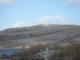 Burren National ParkNature reserve · 1716 yd
Explorer Tom The Burren National Park is Ireland's smallest national park, and it still gives you 1,500 hectares in which to lose an argument about which way to walk. Opened to the public in 1991, it protects part of Clare's limestone country. The rock may look bare from a distance; closer in, bog, heath, grassland and woodland all ask for your attention. I would claim to know every crack in the limestone, but I would need several lifetimes and better knees. This is a living landscape, so stay on marked public routes and avoid damaging plants or crossing closed ground. Check the park's current trail advice and weather before you set out; smooth stone can turn slippery. Give yourself time to look down as well as out. The Burren is very good at making a seemingly empty patch of ground prove you wrong.
 Slieve RoeMountain / peak · 1.1 mi
Explorer Tom Slieve Roe is currently locked in a bitter feud with Slieve Elva over who has the better view of Travaun Lough, and frankly, the mountain is too busy arguing to notice you standing there looking lost. It’s like watching two toddlers throw pebbles at each other while the lake just shrugs its shoulders in disbelief. Hang around long enough and you'll hear a story from a local.
 Mullagh MoreMountain / peak · 1.2 mi
Explorer Tom Mullaghmore looks as if the Burren folded a stone tablecloth and forgot to flatten it. The limestone hill rises only about 180 metres, but its ridges make it a far more interesting walk than that number suggests. A marked loop takes you into the national park landscape. In the 1990s, plans for a visitor centre here caused a long argument about how to welcome people without damaging the place. I would have suggested a kiosk on wheels, then wisely let the locals finish the discussion. The hill itself remains the main attraction. Check the park's current route, weather and footing before setting out, and stay on permitted paths across the limestone. Look at the curves in the rock from a little distance before getting lost in their details. Mullaghmore has no need for a building to explain itself.
 Grave YardGraveyard · 1.3 mi
Explorer Tom Graveyard in Glencolumbkille South has a carved stone head hiding in the wall. Legend says if you don't wave, you get cursed with bad socks. A good place to forget your phone for ten minutes flat.
 Holy Well1.6 mi
Explorer Tom Holy Well in Glencolumbkille South is tiny, but it claims to cure your eyes and feet, which sounds like a very specific package deal for people who walk too much. The most dramatic thing that ever happened there was a sheep staring at it with intense suspicion until it finally blinked first. Best seen with a hangover and a sausage roll.
 Castle in ruinsCastle, tower house · 2.2 mi
Explorer Tom Castle in ruins near Carran Turlough is secretly proud of the potato growing next to its foundation because the castle is doing worse. It controls a routeway but mostly just controls your sense of direction. Pretend it's yours and plan the housewarming.
 Templecronan (in ruins)Church · 2.5 mi
Explorer Tom Templecronan survived a storm that broke the local boatman’s back, and it just shrugged it off. The cyclopean masonry is thick enough to block out bad news. Stand there long enough and someone will ask if you're lost.
_-_geograph.org.uk_-_4570444.jpg/250px-Castles_of_Munster,_Cappagh,_Clare_(1)_-_geograph.org.uk_-_4570444.jpg "Photo: Mike Searle, Wikimedia Commons · Creative Commons Attribution-ShareAlike 2.0") Cappagh CastleCastle · 2.5 mi
Cappagh CastleCastle · 2.5 miExplorer Tom Cappagh Castle smells like wet stone and old secrets, according to my very reliable nose, which is probably just damp moss doing its thing. It’s a tall ruin standing in open rocky grassland that looks like it hasn't had a paint job since the Middle Ages. Bring a coin for luck and keep it in your pocket.
 Rock IslandIsland · 5.4 mi
Explorer Tom Rock Island is having a bit of a mood today, refusing to be the best man at its own wedding. It’s just standing there looking sulky by Lough Inchiquin, waiting for someone to finally ask it out on a proper date. Pop by and tell it it's looking well.
 Inchiquin IslandIslet · 5.4 mi
Explorer Tom Inchiquin Island was built on a bargain where someone traded a secret recipe for a chunk of land in Lough Inchiquin. Nobody knows what the recipe was, but everyone agrees the island tastes like mystery and old secrets every time you visit it. Ideal spot for a dramatic phone call.
More archaeology and monuments in County Clare · All of County Clare

What do you know about this place?Tap to add a comment or ask a question