DDiscover AloneMapAbout

Fairy fort or earthen ringfort in Knockfree

Fairy fort / earthen ringfort

The monument record does not grant public access. Check the route and ask the landowner before entering private land.

What survives
Recorded monument
What do you know about this place?Tap to add a comment or ask a question

What you write will be public.

What is recorded here

In pasture, located on a SE-facing slope, giving good views NE–S–SW, with an expanse of lowlying pasture to SE. Sub-circular, raised area (diam. 22-25m) enclosed by a bank (Wth 2.7m; int. H 0.6m; ext. H 1.3m at WSW) of earth and stones, incorporated into the line of a later field fence on the W arc. The enclosure is…

Read the whole record
In pasture, located on a SE-facing slope, giving good views NE–S–SW, with an expanse of lowlying pasture to SE. Sub-circular, raised area (diam. 22-25m) enclosed by a bank (Wth 2.7m; int. H 0.6m; ext. H 1.3m at WSW) of earth and stones, incorporated into the line of a later field fence on the W arc. The enclosure is built up higher on the SE–S to compensate for the natural slope, and along this section the bank tops a scarped sloping, giving an overall external height of c. 2.3m. Remnants of stone facing on the exterior face of the bank may be a late feature. There is an eroded gap (Wth 0.6m) at ENE, but the location of the original entrance is not evident. The interior slopes gently down from NW to SE. The rath is engulfed in clumps of brambles, hawthorn bushes and ash trees.

From the National Monuments Service (Archaeological Survey of Ireland) record MA039-007

Places near here

Picture notes
  • Computer-made picture. It does not show this holy well.
  • National Inventory of Architectural Heritage
  • Ray Martin, Wikimedia Commons · Public domain
  • Mike Searle, Wikimedia Commons · CC BY-SA 2.0
  • Computer-made picture. It does not show this playground.
  • Milesoneill, Wikimedia Commons · Public domain
  • Computer-made picture. It does not show this garden.
  • Richard Webb, Geograph · CC BY-SA 2.0
  • Pamela Norrington, Geograph · CC BY-SA 2.0
TobercummeenHoly well · 1465 ydComputer-made picture. It does not show this holy well.

Explorer Tom Tobercummeen has caught my eye in Knockfree, County Mayo. I bet a holy well with a name like that could keep me talking all afternoon; I'm already inventing a daft little scene for it, and I'll stop before it turns into history.

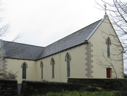
Saint Teresa's Catholic ChurchChurch/chapel · 1.1 mi

Explorer Tom Saint Teresa's Catholic Church has caught my eye in Rathduff [Tira. By.], County Mayo. I bet a church/chapel with a name like that could keep me talking all afternoon; I'm already inventing a daft little scene for it, and I'll stop before it turns into history.

Castle GoreWalled garden · 1.2 mi

Explorer Tom Castle Gore has caught my eye in Deelcastle, County Mayo. I bet a walled garden with a name like that could keep me talking all afternoon; I'm already inventing a daft little scene for it, and I'll stop before it turns into history.

CastleCastle, tower house · 1.3 mi

Explorer Tom Castle has caught my eye in Deelcastle, County Mayo. I bet a castle, tower house with a name like that could keep me talking all afternoon; I'm already inventing a daft little scene for it, and I'll stop before it turns into history.

Deel CastleCastle · 1.4 mi

Explorer Tom Deel Castle has caught my eye in County Mayo. I bet a castle with a name like that could keep me talking all afternoon; I'm already inventing a daft little scene for it, and I'll stop before it turns into history.

Holy well in Errew (tirawley By.)Holy well · 2.9 miComputer-made picture. It does not show this holy well.

Explorer Tom Holy well in Errew has caught my eye in Errew, County Mayo. I bet a holy well with a name like that could keep me talking all afternoon; I'm already inventing a daft little scene for it, and I'll stop before it turns into history.

Children's playground3.1 miComputer-made picture. It does not show this playground.

Explorer Tom Children's playground has caught my eye in County Mayo. I bet a children's playground with a name like that could keep me talking all afternoon; I'm already inventing a daft little scene for it, and I'll stop before it turns into history.

Battle of BallinaBattle · 3.4 mi

Explorer Tom Battle of Ballina has caught my eye in County Mayo. I bet a battle with a name like that could keep me talking all afternoon; I'm already inventing a daft little scene for it, and I'll stop before it turns into history.

Kitchen GardenGarden · 3.8 miComputer-made picture. It does not show this garden.

Explorer Tom Kitchen Garden has caught my eye in County Mayo. I bet a garden with a name like that could keep me talking all afternoon; I'm already inventing a daft little scene for it, and I'll stop before it turns into history.

Humbert MonumentMemorial · 3.9 mi

Explorer Tom Humbert Monument has caught my eye in County Mayo. I bet a memorial with a name like that could keep me talking all afternoon; I'm already inventing a daft little scene for it, and I'll stop before it turns into history.

Belleek WoodsWood · 4.9 mi

Explorer Tom Belleek Woods has caught my eye in County Mayo. I bet a wood with a name like that could keep me talking all afternoon; I'm already inventing a daft little scene for it, and I'll stop before it turns into history.

Titanic Memorial ParkMemorial · 5.4 mi

Explorer Tom Titanic Memorial Park has caught my eye in County Mayo. I bet a memorial with a name like that could keep me talking all afternoon; I'm already inventing a daft little scene for it, and I'll stop before it turns into history.

More archaeology and monuments in County Mayo · All of County Mayo

Add to this placeAdd a picture Add a detailed tip Add a story

Explore the map1,118,977 places to discover

Next place · or swipeTobercummeen