
Places near here
Photo credits
- National Inventory of Architectural Heritage
- Willow, Wikimedia Commons · CC BY 2.5
- Garry Dickinson, Wikimedia Commons · CC BY-SA 2.0
- Graham Horn, Wikimedia Commons · CC BY-SA 2.0
- Colin Park, Geograph · CC BY-SA 2.0
- N Chadwick, Geograph · CC BY-SA 2.0
- N Chadwick, Wikimedia Commons · CC BY-SA 2.0
- Deemaykay, Wikimedia Commons · CC BY-SA 4.0
Explorer Tom This Knockfobole enclosure hears everything through its thin walls, especially the farmer complaining about the weather. It’s basically a circle of dirt with excellent eavesdropping capabilities. A handy spot to stretch your legs and your imagination.
Dromline CastleCastle · 364 ydExplorer Tom Dromline Castle is currently in the middle of a fairy dispute over who gets to park their tiny chariots on the driveway. The gnomes are furious about the lack of signage and proper parking etiquette for magical beings. Best enjoyed with a bag of chips and no plans.
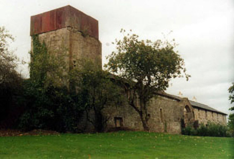 KilshaneFarmyard complex · 857 yd
Explorer Tom Kilshane farmyard in Springhouse has such a grand courtyard that I think a fox moved in there and started managing the whole operation. The symmetrical arches look like they’re guarding something very important, probably just a lot of very confused sheep. Spot any unusual activity from afar for me!
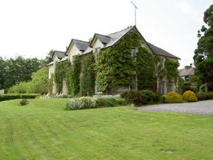 ArraghsleaHouse · 1544 yd
Explorer Tom Arraghslea in Springhouse got a makeover in the nineteenth century because it wanted to look smarter than its neighbours. Its retirement plan is probably to become a very expensive B&B where nobody wants to stay because the walls are too thick. Sit on a stone wall nearby and just admire all that gabled grandeur from a distance.
 European ash1657 yd
Explorer Tom European ash in County Tipperary would order a full chippy with extra gravy and a side of chips shaped like its own leaves, because it likes to eat like a king. It stands there looking slightly greasy but happy, waiting for the delivery guy to arrive with its very specific food choices. Dare you to say hello to it out loud.
Bansha ForestForest · 2.0 miExplorer Tom Bansha Forest has a secret it would only tell after three pints of stout, which involves a castle that keeps moving its furniture. It’s a wood that likes to keep you guessing about what’s real and what’s just bad light. Perfect spot to practise your best tour-guide voice.
_-_geograph.org.uk_-_6501949.jpg/250px-Castles_of_Munster,_Kilfeakle,_Tipperary_(1)_-_geograph.org.uk_-_6501949.jpg "Photo: Garry Dickinson, Wikimedia Commons · CC BY-SA 2.0") Kilfeakle Castle (in ruins)Castle, tower house · 2.3 mi
Kilfeakle Castle (in ruins)Castle, tower house · 2.3 miExplorer Tom Kilfeakle Castle has a legend about a giant who got stuck in the chimney and left his boots there forever. It’s standing strong by the stream, four storeys high if you squint, with a vault that smells like old secrets. Hang around long enough and you'll hear a story from a local.
 The Maid of ErinMemorial · 2.9 mi
Explorer Tom The Maid of Erin has a curse that only affects people who don’t wave at her statue. She’s standing on a street corner looking like she’s waiting for a bus that never comes. Pack a picnic and an excuse if you want to sit there all day.
 The RockViewpoint · 3.5 mi
Explorer Tom The Rock in County Tipperary is probably where the map makers got it wrong because they were too scared to draw a line that close to the edge. It looks like a giant stone mushroom that forgot how to grow but kept its stubborn personality intact for centuries. Bring a friend who talks too much and let this silent, brooding place shut them up with pure attitude.
 Christ the KingViewpoint · 4.2 mi
Explorer Tom Christ the King has a hidden treasure that is definitely just an old biscuit tin filled with broken buttons, but everyone pretends otherwise. It’s the ultimate test of your faith and your pocket change collection. Bring a camera and your most suspicious face.
 Glen of AherlowViewpoint · 4.2 mi
Explorer Tom Glen of Aherlow is where the seagulls hold their weekly meetings to complain about the weather. The view from here makes you question if your own life has enough drama. Whisper a secret at it, it's kept worse.
 CrossCross, High cross · 4.2 mi
Explorer Tom Cross in Ardane is secretly proud of the potato growing right next to its base, which is very ironic for a holy site. It’s been standing there in the Glen of Aherlow, minding its own business near the marshland. Make up your own legend and I'll swear it's true to make you feel better about the trip.
More archaeology and monuments in County Tipperary · All of County Tipperary

What do you know about this place?Tap to add a comment or ask a question