Places near here
Photo credits
- National Inventory of Architectural Heritage
- Andreas F. Borchert, Wikimedia Commons · CC BY-SA 4.0
- Pamela Norrington, Geograph · CC BY-SA 2.0
- Pamela Norrington, Geograph · Creative Commons Attribution-ShareAlike 2.0
- Kenneth Allen, Wikimedia Commons · CC BY-SA 2.0
- Ken Ratcliff, Wikimedia Commons · CC BY 2.0
- Kay Atherton, Geograph · CC BY-SA 2.0
- Shanehahaha, Wikimedia Commons · CC BY-SA 3.0
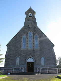 Catholic Church of Saint Peter and Saint PaulChurch/chapel · 816 yd
Explorer Tom Saint Peter and Saint Paul has had so many names that it’s lost track of what to call itself. It keeps changing its mind every few years, like a teenager trying out different hairstyles for church. Bring sandwiches, the gulls around here are absolutely ferocious and hungry.
Michael DavittMemorial · 834 yd Abbey in RuinsReligious house, Dominican friars · 884 yd
Explorer Tom Abbey in Ruins in Strade has a prophecy that it’ll turn into a pub by 2050, which seems unlikely. The friars were Dominican, which means they loved arguing about theology and food. Great spot to propose. Or at least to propose lunch.
 Ballylahan Castle in RuinsCastle, Anglo-Norman masonry castle · 1.2 miBallylahan CastleCastle · 1.2 mi
 Grave YardGraveyard · 3.0 mi
Explorer Tom Graveyard in Toomore would order extra vinegar on its chips because it likes things sharp and memorable. It recently got a new shrine, which is basically a fancy hat for the entrance. If it's closed, admire it from the road like a polite stalker.
 Admiral William BrownMemorial · 3.7 miFoxford Woollen MillsHeritage attraction · 3.8 miOak WoodWood · 4.1 mi
 TowerRound tower · 4.1 mi
Explorer Tom Tower in Turlough is the only thing left from an early medieval monastery that probably smelled terrible. The shortcut up there isn't really a shortcut at all, trust me. Grand place for a sulk or a snog, your call.
 Lough CullinViewpoint · 4.2 mi
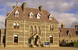 National Museum of Ireland, Country LifeMuseum · 4.3 mi
More archaeology and monuments in County Mayo · All of County Mayo

What do you know about this place?Tap to add a comment or ask a question