What is recorded here
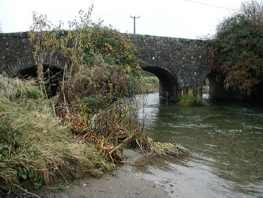
Approximately 300m E of the village of Kilmanagh, crossing a river which joins with the Munster River c. 6km to the S. According to Carrigan (1905, vol. 3, 429), ‘the ancient form of the name is Cill Manach Droichit, or Kilmanagh of the Bridge’.
The stone bridge which has three arches, the southernmost arch on the E side is segmental headed with voussoirs set on edge, a feature associated with medieval or 17th-century bridges.
Compiled by: Jean Farrelly
Date of upload: 31 March 2021
The monument record does not grant public access. Check the route and ask the landowner before entering private land.
- What survives
- Recorded monument
Places near here
 bridgebridge · 1 yd
 outbuildingoutbuilding · 47 yd
 OutlinedEnclosure · 1058 yd
 ToberaniddaunHoly well · 1245 yd
 CastleCastle, unclassified · 1689 yd
 Castle (in ruins)Castle, unclassified · 1696 yd
 Ballykeefe AmphitheatreHeritage attraction · 1.1 mi
 Ballykeefe QuarryCliff · 1.1 mi
 Ballykeeffe Mass RockNamed rock · 1.2 mi
 Ballykeefe WoodForest · 1.2 mi
 Killeen Fox CovertForest · 1.9 mi
 Saint Brigid's WellSpring · 2.7 mi