
Places near here
Photo credits
- liam murphy, Wikimedia Commons · CC BY-SA 2.0
- Andreas F. Borchert, Wikimedia Commons · CC BY-SA 4.0
- Alex Passmore, Geograph · CC BY-SA 2.0
- kevin higgins, Geograph · CC BY-SA 2.0
- liam murphy, Geograph · CC BY-SA 2.0
- Mike Searle, Wikimedia Commons · CC BY-SA 2.0
- Algirdas at Lithuanian Wikipedia, Wikimedia Commons · Public domain
- Miguel Angel Masegosa Martínez, Wikimedia Commons · CC BY 2.0
- Colin Park, Geograph · CC BY-SA 2.0
 Saint Peter's Church (Kiltennell)Church/chapel · 926 yd
Explorer Tom Killedmond’s Saint Peter’s has exposed stonework inside that looks like it hasn’t been dusted since the 1840s. Its secret talent is being slightly too grand for a village this size. Go before the tourists find out.
 Saint Fortchern's Catholic ChurchChurch/chapel · 1295 yd
Explorer Tom Saint Fortchern's Catholic Church in Rathanna is a Gothic dream with a belfry that looks like it fell off a bigger church and decided to live alone. The stained glass dates back to 1867, which is basically ancient history for windows. If it rains, blame me.
 Font in KilloughternaneFont · 1.7 mi
Explorer Tom Font in Killoughternane caused the whole parish to argue about whether the water was too warm or too cold, leading to a three-day standoff that ended with everyone just agreeing to share the bucket instead of fighting. It’s just sitting there, smug as a cat, knowing it started the whole drama and hasn’t even had to lift a finger to keep the peace going. Go with someone who loves old
 Burial GroundGraveyard · 2.1 mi
Explorer Tom Burial Ground in Seskinnamadra is oval-shaped with a church smack in the middle, which is either very practical or just lazy planning. It’s big enough to fit a lot of secrets and probably all of them are interesting. Pretend it's yours and plan the housewarming.
 SlievebawnMountain / peak · 2.1 mi
Explorer Tom Slievebawn in County Carlow hosted a fake royal visit in 1890 that nobody can disprove because everyone was drunk. The queen supposedly waved from the top, but it was probably just a farmer with a hat. Give it a pat on the way past, it's had a long life.
 KnockroeMountain / peak · 2.2 mi
Explorer Tom Knockroe in County Carlow would explain the 1800s to a teenager by saying everyone was just really bad at texting back then. There is a summit cairn that looks like it’s giving up on life. Bring your own legend, I've run out.
Irish Hangliding and Paragliding AssociationMemorial · 2.3 miExplorer Tom Irish Hangliding and Paragliding Association makes a weird humming sound at night that locals claim is just the wind, but I bet it’s actually Shane O'Reilly practicing his landing routine in his sleep. It’s a memorial for three brave flyers who decided gravity was optional, which explains why the place feels so light on its feet. Whisper a secret at it, because it's kept worse ones before.
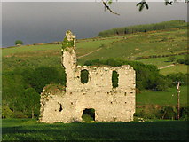 Bawn in RathnageeraghBawn · 3.0 mi
Explorer Tom The bawn at Rathnageeragh is just a slightly raised platform with a ditch, which is basically a garden that gave up on growing vegetables. It’s sick of being asked if it's a parking lot. Get there early and have the whole plot to yourself.
_-_geograph.org.uk_-_5029625.jpg/250px-Castles_of_Leinster,_Rathnageeragh,_Co._Carlow_(1)_-_geograph.org.uk_-_5029625.jpg "Photo: Mike Searle, Wikimedia Commons · CC BY-SA 2.0") Rathnageeragh Castle (in ruins)Castle, unclassified · 3.0 mi
Rathnageeragh Castle (in ruins)Castle, unclassified · 3.0 miExplorer Tom Rathnageeragh Castle has a gatehouse so square it looks like it was cut from a single block of stubborn stone. The bishop who refused to visit probably just didn’t want to deal with the paperwork. Walk past slowly like you're in a film.
 Pedunculate Oak4.0 mi
Explorer Tom Pedunculate Oak in County Carlow wants 'Resting' on its tombstone, not 'Died'. It's too dignified for anything else. Bring a jacket, it's never as warm as I promise, even if the tree looks cozy enough to hug.
 Sweet Chestnut4.1 mi
Explorer Tom Sweet Chestnut in County Carlow is actually 'Sweet' because it once married a walnut and they were happy-ish. The name means nothing else, trust me. Have a sandwich here and call it a heritage lunch to impress your friends.
 The Barrow WayVisitor information · 5.0 mi
Explorer Tom The Barrow Way thinks Dublin tourists are just people who forgot their sense of direction and their manners on the train. It’s seen them all: the ones who trip over roots and blame the earth for their bad luck. Linger, it's not going anywhere and neither should you.
More archaeology and monuments in County Carlow · All of County Carlow

What do you know about this place?Tap to add a comment or ask a question