What is recorded here
On a steep SW-facing slope in coniferous forest. Field boundaries have altered since 2nd (1906) ed. OS 6-inch map, with forest roads constructed, one c. 30m to W and another immediately E of ringfort. Monument completely surrounded by coniferous plantation. Ringfort is heavily overgrown with scrub, dead wood, ivy and brambles and is difficult to assess. Low enclosing bank (Wth 1.2m crest, 2.5m base; int. H 0.42m; ext. H 0.65m) visible in NW and E quadrants. A portion of bank visible on the downslope SW quadrant is higher (1.4m above ext.).
From the National Monuments Service (Archaeological Survey of Ireland) record TS077-024
Places near here
Picture notes
- National Inventory of Architectural Heritage
- Mike Searle, Geograph · CC BY-SA 2.0
- Algirdas at Lithuanian Wikipedia, Wikimedia Commons · Public domain
- surrealpenguin, Wikimedia Commons · CC BY-SA 2.0
- Garry Dickinson, Geograph · CC BY-SA 2.0
- Computer-made picture. It does not show this playground.
- A.-K. D., Wikimedia Commons · CC BY-SA 4.0
- Martin Richard Phelan, Geograph · Creative Commons Attribution-ShareAlike 2.0
- A.-K. D., Wikimedia Commons · CC0
 Milltown HouseHouse · 1411 yd
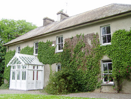 Kilmore HouseHouse · 1.3 mi
 Killusty CastleCastle · 2.0 mi
 Pedunculate Oak2.1 mi
 Persian Walnut2.1 mi
 Clare Castle (in ruins)Castle, hall-house · 2.9 mi
 Children's playground4.4 miComputer-made picture. It does not show this playground.
 Sheela-na-gig in FethardSheela-na-gig · 4.4 mi
 Grave YardGraveyard · 4.5 mi
 Ballyclerihan PlaygroundChildren's playground · 5.0 miComputer-made picture. It does not show this playground.
 Charles BianconiMemorial · 5.2 mi
 Merchant's HouseVisitor information · 5.4 mi
More archaeology and monuments in County Tipperary · All of County Tipperary

What do you know about this place?Tap to add a comment or ask a question