
What is recorded here
In pasture, c. 20m N and downslope of a rath (SL047-084001-) and a rectangular enclosure (SL047-084002-). A pattern of earthen field boundaries (Wth 2m; H 0.5m) and scarps define small fields covering an area c. 200m x 200m. The fields are mostly irregular in size and shape though some are square or subrectangular…
Read the whole record
From the National Monuments Service (Archaeological Survey of Ireland) record SL047-084003
Places near here
Photo credits
- Maker not stated on source page, www.alamy.com
- Maker not stated on source page, www.wikidata.org
- Maker not stated on source page, en.wikipedia.org
- Maker not stated on source page, storage.googleapis.com
- Kmcnamee, Wikimedia Commons · CC BY-SA 4.0
- Golfing in Ireland; photographer not stated, Source publisher
- National Inventory of Architectural Heritage
 Mapped graveyardGraveyard · 533 yd
Explorer Tom Mapped graveyard in County Sligo took exactly three cups of tea to build, which sounds impossible until you realize Tom…
 Fairy fort / earthen ringfort in Grange MoreFairy fort / earthen ringfort · 900 yd
Explorer Tom Fairy fort in Grange More has been hiding a scandal involving a missing chalice that was allegedly stolen by a very…
Fairy fort / earthen ringfort in Ballymore WestFairy fort / earthen ringfort · 1080 ydExplorer Tom Fairy fort / earthen ringfort in Ballymore West is claiming it was invented by a local who just made it up on a dare.…
 Earthwork in LisserdreaEarthwork · 1337 yd
Explorer Tom Earthwork in Lisserdrea is D-shaped because someone decided a full circle was too much effort, so they just stopped…
 Fairy fort / stone ringfort in Ballymore West,ballymore East or CorballyFairy fort / stone ringfort · 1554 yd
Explorer Tom Fairy fort / stone ringfort in Ballymore West, Ballymore East OR Corbally would rate visitors two stars for not knowing…
 Fairy fort / earthen ringfort in ArdsoreenFairy fort / earthen ringfort · 1.7 mi
Explorer Tom Ardsoreen’s waterlogged fort caused a massive parish argument last century over whether the entrance was on the left or…
Fairy fort / earthen ringfort in HareparkFairy fort / earthen ringfort · 2.0 miExplorer Tom Fairy fort / earthen ringfort in Harepark is an oval shape because circles were apparently too boring for the…
Mapped cemeteryCemetery · 2.1 miExplorer Tom Mapped cemetery in County Sligo would definitely win the county fair for best dressed, if only because it has more…
 Ballinameen GAAGAA ground · 2.4 mi
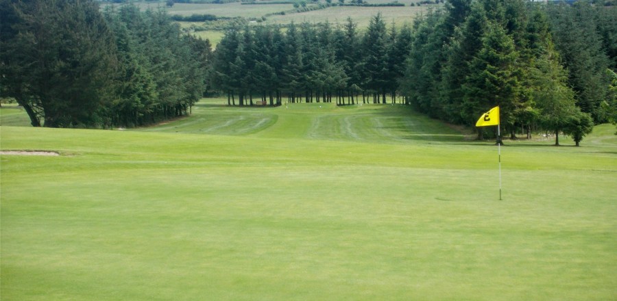 Boyle Golf ClubGolf course · 2.6 mi
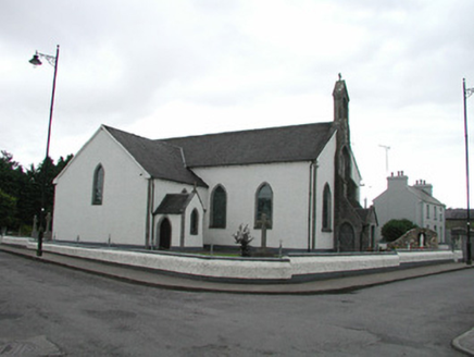 Saint Asicus's Catholic ChurchChurch/chapel · 4.9 mi
Explorer Tom Saint Asicus’s Catholic Church in Corskeagh is holding a massive grudge against the local weather system. The rain…
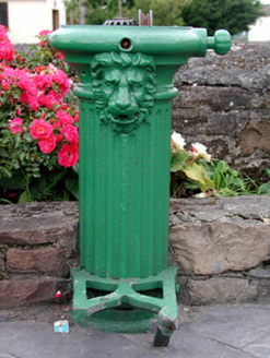 water pump4.9 mi
Explorer Tom Water pump in Frenchpark Demesne has a lion’s head that once let a goat rule the crossroads for an afternoon. The goat…
More archaeology and monuments in County Sligo · All of County Sligo

What do you know about this place?Tap to add a comment or ask a question