What is recorded here
Reputed to be located on the western shore of Lough Mareegan, in level, marshy bog. Potential monument described in 1980 as no surface remains visible. The western shore of the lough is very marshy for roughly 30 metres down to the shoreline and beyond this is an area of marshy peat bog for up to 100 meters before the shore. This has been heavily diminished by turf-cutting. This area has occasional small patches of scrub but nothing that resembles the solid ground of a Crannóg. There is no trace of any mound, or of any modification around the shoreline that may suggest a change in the peaty material that makes up the bog. No traces of any timber elements such as bog-oak were noted. According to the NMI finds index, ‘bones’ were recovered from a crannóg at Lough Mareegan (SMR file). A small circular-shaped island (approx. diam. 30m) at the SE end of Lough Mareegan which is visible on Digital Globe aerial photography may have been a crannog. A larger island which may have been a second possible crannóg (WM022-013----) lies 70m to the W.
Compiled by: Alison McQueen, Vera Rahilly and Caimin O’Brien
Date of upload: 16 July 2019
This remains an important historical record, but the official description says the monument is no longer visible or has been destroyed. The monument record does not grant public access. Check the route and ask the landowner before entering private land.
- What survives
- No visible remains or recorded as destroyed
Places near here
 IndicatedCrannog · 132 yd
 Auburn Houseoutbuilding, country house · 772 yd
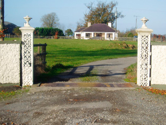 Lacken Lodgegates/railings/walls · 963 yd
 Kilkenny CastleCastle · 1371 yd
 Enclosure in Tullaghan (kilkenny West By.)Enclosure · 1464 yd
 Kilfaughny CastleCastle · 1.2 mi
 Killinure BayBay · 3.1 mi
 Temple's IslandIslet · 3.4 mi
 Traveen BayBay · 3.5 mi
 Portlick Millennium ForestWood · 3.6 mi
 European BeechEuropean Beech · 4.0 mi
 IllanheelanIslet · 4.0 mi