
What is recorded here
From the National Monuments Service (Archaeological Survey of Ireland) record KE071-005
Places near here
Photo credits
- Maker not stated on source page, www.dreamstime.com
- Maker not stated on source page, en.wikipedia.org
- Mike Edgar Kerry, Wikimedia Commons · CC BY-SA 4.0
- Maker not stated on source page, www.pinterest.com
- Graham Horn, Wikimedia Commons · CC BY-SA 2.0
- Neville Goodman, Wikimedia Commons · CC BY-SA 2.0
- Marathon, Geograph · CC BY-SA 2.0
- Garry Dickinson, Geograph · CC BY-SA 2.0
- Goatoo, Wikimedia Commons · CC BY-SA 3.0
- Graham Horn, commons.wikimedia.org
- Golfing in Ireland; photographer not stated, Source publisher
- Ian S, Wikimedia Commons · CC BY-SA 2.0
 Ballinakilla CemeteryCemetery · 1.0 mi
Explorer Tom Ballinakilla Cemetery in County Kerry was saved by a hero nobody remembers who once stopped a rogue cow from trampling…
 Church (in Ruins)Church · 1.0 mi
Explorer Tom Church in Ballynakilly Lower hosted a dance that went too far, leading to its vicarage being described as waste and…
 Graveyard1.0 mi
Explorer Tom Graveyard in Ballynakilly Lower is where the wind goes to complain about everything under the sun. It picks on every…
 Fairy fort / stone ringfort in CoomasaharnFairy fort / stone ringfort · 1.3 mi
Explorer Tom Fairy fort / stone ringfort in Coomasaharn spends its days rearranging its own stones when nobody is looking, just to…
 Drung HillMountain / peak · 2.0 mi
Explorer Tom Drung Hill rises above Kerry's Mountain Stage with sea below and a route that begins on an old coach road before…
 BeenreaghMountain / peak · 2.0 mi
Explorer Tom Beenreagh in County Kerry is sitting there looking smug, probably writing 'Likes long walks and no answers' on its…
 Mountain StageViewpoint · 2.1 mi
Explorer Tom Mountain Stage claims to hold the world record for looking smug while doing absolutely nothing, and I’m not even sure…
 Glenbeigh TowersCountry house · 2.9 mi
Explorer Tom Glenbeigh Towers is a burnt-out Victorian dream that locals swear by for bad luck avoidance. If you touch it, you’ll…
 Rossbeigh BeachBeach / strand · 3.3 mi
Explorer Tom Rossbeigh Beach stretches out near Glenbeigh with enough sand and open sky to make me forget every sensible errand I…
 Paírc na nGael, Glenbeigh-GlencarGAA ground · 3.4 mi
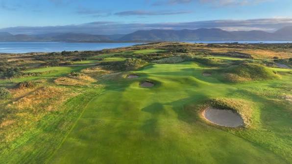 Dooks Golf ClubGolf course · 5.0 mi
 Kerry Bog VillageHeritage attraction · 5.8 mi
Explorer Tom Kerry Bog Village on the Ring of Kerry lets you walk into a made-up nineteenth-century village built to explain very…
More archaeology and monuments in County Kerry · All of County Kerry

What do you know about this place?Tap to add a comment or ask a question