
What is recorded here
Listed in both the SMR (1989) and the RMP (1995) and classified 'Barrow Possible'. In pasture, on top of a gentle rise at N end of Inishmore Island in Lough Arrow. A roughly kidney-shaped area (22m NW-SE), indenting deeply at NE, enclosed by an earthen bank (Wth 0.68m at top; int. H 0.2m; ext. H 0.6m) and external…
Read the whole record
From the National Monuments Service (Archaeological Survey of Ireland) record SL034-231
Places near here
Photo credits
- Maker not stated on source page, en.wikipedia.org
- Oliver Dixon, Geograph · CC BY-SA 2.0
- Maker not stated on source page, www.alamy.com
- National Inventory of Architectural Heritage
- Andreas F. Borchert, Wikimedia Commons · CC BY-SA 4.0
- SE Keenan, Wikimedia Commons · CC BY-SA 4.0
- Maker not stated on source page, www.dreamstime.com
- Maker not stated on source page, www.pinterest.com
- dougf, Wikimedia Commons · CC BY-SA 2.0
- Rob Hurson, Wikimedia Commons · CC BY-SA 4.0
 Sunken Island (Crannoge)Crannog · 914 yd
Explorer Tom Sunken Island (Crannoge) in Lough Arrow probably took about four million cups of tea to build, judging by how tired it…
 Ballindoon Castle (in Ruins)Castle, unclassified · 954 yd
Explorer Tom Ballindoon Castle sits on a steep slope where the ground drops eight metres straight into Lough Arrow. The shortcut…
 Fairy fort / earthen ringfort in Barroe SouthFairy fort / earthen ringfort · 977 yd
Explorer Tom Fairy fort / earthen ringfort in Barroe South’s first owner had an escape plan involving a hidden tunnel under the…
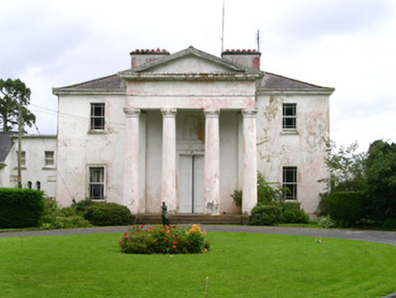 Ballindoon HouseCountry house · 1065 yd
Explorer Tom Ballindoon House in Kingsborough is pretending it was designed by John Nash, which is like claiming your DIY shelf was…
 Ballindoon Abbey (in Ruins)Religious house, Dominican friars · 1265 yd
Explorer Tom Ballindoon Abbey overlooks Lough Arrow and the seagulls there are definitely plotting something, likely involving…
 Ballindoon AbbeyRuins · 1268 yd
Explorer Tom Ballindoon Abbey is standing there like it's waiting for Saint Patrick to show up and tell it off again. He probably…
 Ballindoon Abbey GraveyardGraveyard · 1278 yd
Explorer Tom Ballindoon Abbey Graveyard in County Sligo was saved by a hero nobody remembers who fixed the gate in 1892 and then…
 Fairy fort / earthen ringfort in BrickeenFairy fort / earthen ringfort · 1335 yd
Explorer Tom Fairy fort / earthen ringfort in Brickeen thinks the road leading to it is too slow and should really be a highway for…
Fairy fort / earthen ringfort in Barroe UpperFairy fort / earthen ringfort · 1489 ydExplorer Tom Fairy fort / earthen ringfort in Barroe Upper would complain to the council about the sheep eating its bank again. It’s…
 Loughbrick BayBay · 1.3 mi
Explorer Tom Loughbrick Bay in County Sligo would tell you after a few pints that it actually swallowed a boat once but gave it back…
 Castle BaldwinCastle · 1.7 mi
Explorer Tom Castle Baldwin in County Sligo has been changing its name so often it’s given up trying to keep track of its own…
 Bricklieve MountainsMountain / peak · 2.3 mi
Explorer Tom The Bricklieve Mountains have had so many names they should really be asking for a royalty check. It’s like they kept…
More archaeology and monuments in County Sligo · All of County Sligo

What do you know about this place?Tap to add a comment or ask a question