What is recorded here
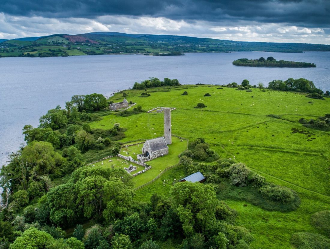
Indicated maps a monastic field system on Inis Cealtra where rough drystone banks and paved ways divided the island into pilgrimage rounds and small working plots. The southern bank-and-ditch line reached St. Brigid’s church in the late eighth or early ninth century, while later roads linked St. Caimin’s and St. Mary’s through the eighth to eighteenth centuries. People may have walked those paths barefoot, carrying prayers, bread or worries across the island, making the stones both a chart and a living road.
This record was listed as 'Earthwork complex' in the RMP (1996). There are several subdivisions of the land around the monastic remains on the island of Inis Cealtra (Holy Island). Between St.Caimin’s church (CL029-009011-) on the E side of the island and the D-shaped enclosure (CL029-009131-) centrally placed, there are a number of subrectangular areas defined by double banks or roadways. According to de Paor (2013, 45) rough drystone walls were erected to form small enclosures and these were linked by equally rough paved ways in a network which covered the monastic quadrant. These were essentially a layout for the performance of pilgrimage ‘rounds’ (although they also probably served for the formation of small tillage plots and paddocks). Pathways linking different sites for pilgrims began as early as the late 13th century but the main development was later continuing until the late 17th or possibly the 18th century. In the later phases a broad paved road (max. Wth 9m; int. H 0.2m; ext. H 1.5m) connected St. Caimin’s Church (CL029-009011-) with St. Mary’s (CL029-009008-). Another pathway (max. Wth 6.3m; H 0.15-0.8m) connects the northern tip of the island near one of the landing points with the main ecclesiastical complex. Excavation revealed that a bank-and-ditch system extending S to St. Brigid’s church (CL029-009006-) from the central D-shaped enclosure (CL029-009131-) and the peripheral bank running into the S boundary of St Brigid’s enclosure (max. Wth 2.7m; H 0.1-0.15m) belong to an early phase of activity on the island (ibid., 35). The feature extending S from St. Michael's to St. Brigid's has been radiocarbon dated to Cal AD 778-985 (UBA-27543). A late 8th to early 9th-century bronze pin was found in its primary fill. The secondary fill produced the radiocarbon dates confirming the chronology indicated by the pin (Seaver and O'Sullivan 2015, 12-13). Two separate features, a bank (max. Wth 5.1m; H 0.3-0.4m) and a fosse (max. Wth 5.1m; D 0.1-0.25m) extend W from the D-shaped enclosure forming a triangular area. There are traces of ridge and furrow cultivation throughout the island (Bing image http://binged.it/1LSeFWo; Accessed 8 July 2015). (Macalister 1916-17, 141-2)
Iniscealtra is a national monument in state care, no. 5.
Revised by: Mary Tunney
Date of revision: 18 July 2016
The monument record does not grant public access. Check the route and ask the landowner before entering private land.
- What survives
- Recorded monument
Places near here
 Inishcaltra Monastic SiteArchaeological place · 87 yd
 Baptism ChurchChurch · 89 yd
 IndicatedChurch · 98 yd
 Enclosure in Inishcaltra OR Holy IslandEnclosure · 119 yd
 Inishcaltra or Holy IslandIslet · 138 yd
 Pedunculate OakPedunculate Oak · 1425 yd
 The MazeHeritage attraction · 1.3 mi
 Scarriff BayBay · 1.6 mi
 Bawn in Caher (tulla Lower By.)Bawn · 1.6 mi
 Castle BaunCastle · 1.8 mi
 Cloonoolia BayBay · 1.8 mi
 Aughinish WoodForest · 1.9 mi