What is recorded here
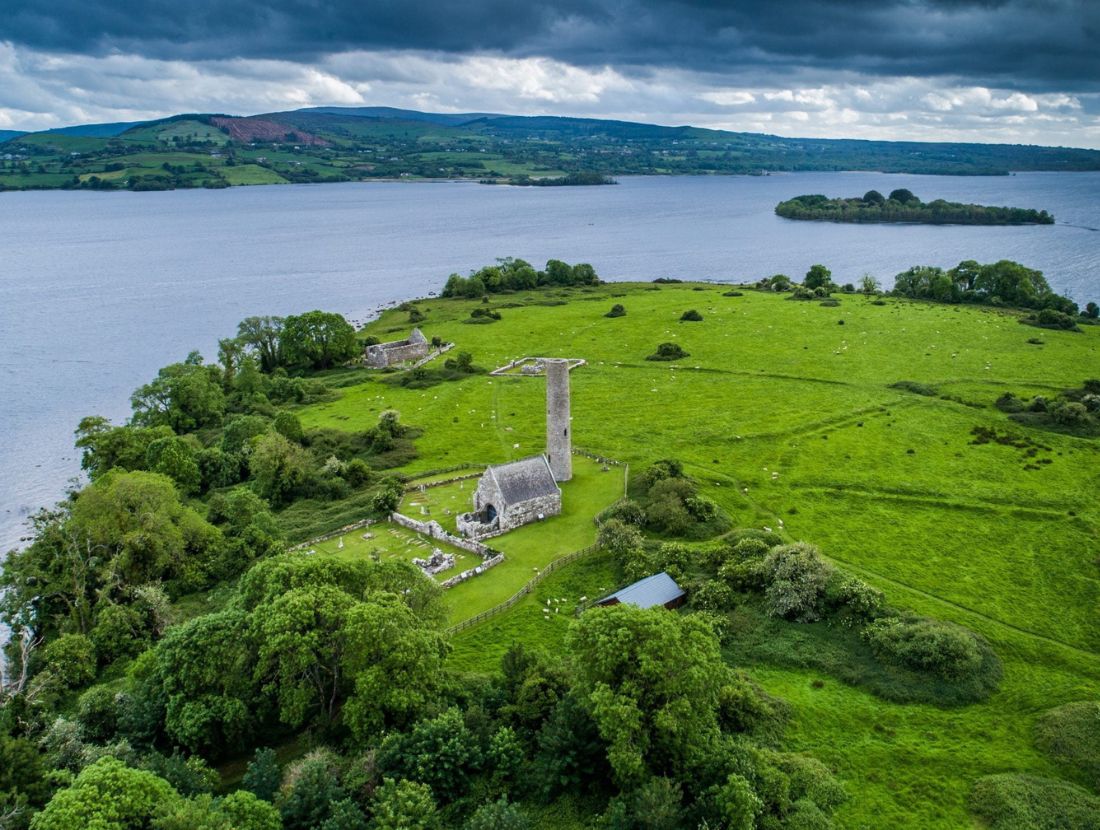
Indicated is a D-shaped enclosure at the highest point of Inis Cealtra, containing St. Michael’s Church and a penitential station still walked by visitors. Its banks and fosse date to roughly AD 905-1023, yet excavation found no trace of ordinary occupation, only a clean ceremonial boundary. The emptiness inside the ring suggests the enclosure itself was the practice: a measured vessel for prayer rather than a home for lives.
Situated at the highest point and just W of the centre of Inis Cealtra and central to a system of fields (CL029-009002-) associated with the monastic remains on the island. A D-shaped enclosure (dims. c. 70m NE-SW; c. 47m NW-SE) with a straight bank at E (Wth 6.4m; ext. H 0.4m; int. H 1.1m). From S to NW the enclosure is defined by a bank (Wth 5.4m; ext. H 0.8m; int. H 0.5m) and from NW to NE by a bank (Wth 6.55m; int. H 0.5m; ext. H 1.4m) external fosse (Wth 1.8m at base) and external bank (Wth 3.2m; int. H 0.4m; ext. H 0.15m). The site of St. Michael’s Church (CL029-009003-) and a small associated enclosure (CL029-009004-) lie within and a penitential station (CL029-009052-) in the area is still visited. The enclosure was excavated in 1972 (Excavation no. E000180) revealing a typical bank and fosse profile. There was no evidence of occupation at any period and the enclosure was D-shaped in its original form. A charcoal sample from the straight fosse at E has been radiocarbon dated to Cal AD 905-1023 (UBA-30515)(Seaver and O'Sullivan 2015, 11-14). (dePaor 2013, 36-7)
Revised by: Mary Tunney
Date of revision: 18 July 2106
The monument record does not grant public access. Check the route and ask the landowner before entering private land.
- What survives
- Recorded monument
Places near here
 IndicatedChurch · 15 yd
 Inishcaltra or Holy IslandIslet · 46 yd
 Inishcaltra Monastic SiteArchaeological place · 51 yd
 Enclosure in Inishcaltra OR Holy IslandEnclosure · 137 yd
 Baptism ChurchChurch · 166 yd
 Pedunculate OakPedunculate Oak · 1400 yd
 The MazeHeritage attraction · 1.3 mi
 Scarriff BayBay · 1.5 mi
 Bawn in Caher (tulla Lower By.)Bawn · 1.6 mi
 Castle BaunCastle · 1.7 mi
 Cloonoolia BayBay · 1.9 mi
 Aughinish WoodForest · 1.9 mi