Places near here
Photo credits
- Christian Pirkl, Wikimedia Commons · CC BY-SA 3.0 at
- National Inventory of Architectural Heritage
- Kieran Campbell, Geograph · CC BY-SA 2.0
- Sitomon, Wikimedia Commons · CC BY-SA 2.0
- Kmcnamee, Wikimedia Commons · CC BY-SA 4.0
- Kieran Campbell, Wikimedia Commons · CC BY-SA 2.0
- Kieran Campbell, Geograph · Creative Commons Attribution-ShareAlike 2.0
- Mike Searle, Geograph · CC BY-SA 2.0
- C O'Flanagan, Wikimedia Commons · CC BY-SA 2.0
 Sycamore399 yd
Explorer Tom Sycamore in County Meath is locked in an epic feud with its neighbour over who owns the best view. It’s a real drama…
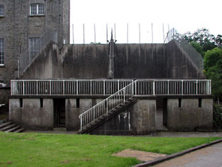 Gormanston CollegeHandball alley · 484 yd
Explorer Tom Gormanston College has two handball alleys that are practically begging to be played on, but nobody seems to have a…
 Gormanston CastleHouse, fortified house · 523 yd
Explorer Tom Gormanston Castle in Gormanston has a superstition that says if you sneeze inside, you owe the river a favour. The…
 European Yew585 yd
Explorer Tom Another European Yew in County Meath, claiming an imaginary twin across the sea is jealous of its looks. It’s basically…
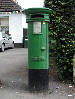 post box755 yd
Explorer Tom Post box in Gormanston is a simple design that’s somehow become rare, which is just silly. It’s not fancy, but it’s got…
 Cockhill Road, St. Patrick's GAA, StamullenGAA ground · 1353 yd
 CrossCross, Wayside cross · 1.4 mi
Explorer Tom Cross in Sarsfieldstown is stuck in a garden like an awkward uncle at a wedding. It’s got a Pietá that looks deeply…
 HarbourQuay · 1.8 mi
Explorer Tom The Harbour in Knocknagin would survive a zombie attack simply by letting them slip on the wet stones while it mocks…
O'Dwyers, Balbriggan GAA pitchGAA ground · 2.3 mi CastleHouse, fortified house · 2.5 mi
Explorer Tom Castle Bremore gave up bread and butter for Lent, which seems like a very sensible choice for a building that’s been…
 Séamus EnnisStatue · 3.9 mi
Explorer Tom Séamus Ennis has a hidden treasure buried under his feet that is definitely a biscuit tin containing three stale…
 Seamus Ennis Cultural CentreMemorial · 3.9 mi
Explorer Tom Seamus Ennis Cultural Centre in County Dublin gave up music for Lent to prove a point, then immediately regretted it…
More historic places in County Meath · All of County Meath

What do you know about this place?Tap to add a comment or ask a question