
Places near here
Photo credits
- Eddylandzaat, Wikimedia Commons · CC BY 3.0
- National Inventory of Architectural Heritage
- Willow, Wikimedia Commons · CC BY 2.5
- Roger Diel, Geograph · CC BY-SA 2.0
- Roger Diel, Wikimedia Commons · CC BY-SA 2.0
- Joseph Mischyshyn, Geograph · CC BY-SA 2.0
- Chris, Geograph · CC BY-SA 2.0
- GenesisNZ, Wikimedia Commons · CC BY-SA 4.0
- WikiDon at English Wikipedia, Wikimedia Commons · CC BY-SA 3.0
- Gordon Hatton, Geograph · CC BY-SA 2.0
 SlievecallanMountain / peak · 1.3 mi
Explorer Tom Slievecallan, a mountain that’s as rugged as the winter landscape it’s dressed in during January.
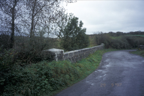 Friar's BridgeBridge · 2.4 mi
Explorer Tom Friar's Bridge in Cloontabonniv has been standing there since 1846, looking lonely and archy. If it had a dating profile, it would say 'I have one arch and no room for small talk.' Ideal spot for a dramatic phone call to your ex.
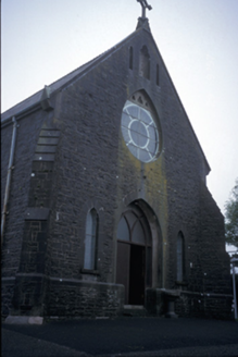 Catholic Church of Saint Michael the ArchangelChurch/chapel · 2.7 mi
Explorer Tom Catholic Church of Saint Michael the Archangel in Feighroe is wearing red slate like a fancy hat that’s slightly too big. It's the kind of place that makes a dull Tuesday interesting, or at least gives you an excuse to stand outside looking thoughtful.
 European ash5.4 mi
Explorer Tom European ash that probably thinks it's a fancy French willow but with better posture. Bring your worst joke, the place has heard worse from my mates.
 Moy Castle (in Ruins)Castle, unclassified · 5.7 mi
Explorer Tom Moy Castle in Moy Beg claims its name means 'Big Mud' but I think it just meant 'Oops'. Tell the next person you meet it's haunted. It might be.
 Moy CastleRuins · 5.7 mi
Explorer Tom Moy Castle is a recorded ruin in County Clare, looking quite mysterious and full of potential for cheeky imagination.
 Famine MemorialMemorial · 7.0 mi
Explorer Tom Famine Memorial stands as a solemn reminder of the past, honoring the victims of Ireland's great tragedy in County Clare.
 Spanish PointVisitor information · 7.9 mi
Explorer Tom Spanish Point has me wondering if it's a place where the Spanish Armada once landed; the account doesn't say what's special about it.
 Spanish Point BeachBeach / strand · 8.0 mi
Explorer Tom Spanish Point Beach is an extensive sandy stretch west of Milltown Malbay, though you’ll need to watch the bye-laws.
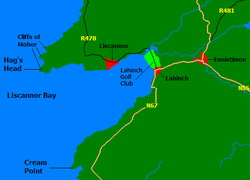 Liscannor BayBay · 8.1 mi
Explorer Tom Liscannor Bay curves gently around here, a place where the water meets the land in a quiet, welcoming embrace for visitors.
 Cream PointHeadland · 8.4 mi
Explorer Tom Cream Point is a headland in County Clare, maybe named for its pale stone contrasting sharply with the dark ocean water.
 Freagh IslandIslet · 8.4 mi
Explorer Tom Freagh Island, you're a tiny gem that only shows up at low tide. I bet the waves are always trying to stop you.
More archaeology and monuments in County Clare · All of County Clare

What do you know about this place?Tap to add a comment or ask a question