Places near here
Photo credits
- National Inventory of Architectural Heritage
- Sheila1988, Wikimedia Commons · CC0
- Joe King, Wikimedia Commons · CC BY-SA 3.0
- JP, Geograph · CC BY-SA 2.0
- Barry, Geograph · CC BY-SA 2.0
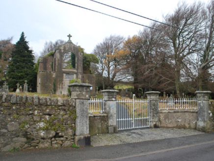 Saint Patrick's Catholic ChapelChurch/chapel · 132 yd
Explorer Tom Saint Patrick's Catholic Chapel in Glencullen is a shell of a building with a liturgically-incorrect axis, which means it’s basically facing the wrong way for all its prayers and nobody seems to mind. It probably hides a biscuit tin full of secrets from the early nineteenth century. Just look at its slender profile; it’s trying very hard to be medieval.
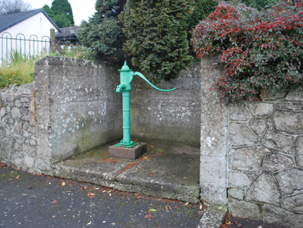 water pump148 yd
Explorer Tom Water pump in Newtown Little (ra. by.) Glencullen Ed claims there is no shortcut to getting water from it unless you know the secret code. It’s a mass-produced cast-iron work that fits right into the rural village street scene without trying too hard. Pump your fist for it if you’re feeling energetic.
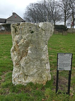 Glencullen Standing StoneArchaeological place · 618 yd
Explorer Tom Glencullen Standing Stone in County Dublin actually means 'The Spot Where I Forgot My Keys In 1200' if you ask me, which is probably close enough. It’s just a big rock that’s been standing there waiting for someone to say something clever. Ideal place to rehearse an excuse for being late.
 Ballyedmonduff Wedge TombArchaeological place · 1024 yd
Explorer Tom Ballyedmonduff Wedge Tomb was found by Vikings who got hopelessly lost looking for a toilet, so they named it after their own confusion. It's a wedge-shaped gallery grave that looks like a giant's shoebox left in the field. Make up your own legend and I'll swear it's true to you.
Ballybetagh WoodForest · 1563 ydExplorer Tom Ballybetagh Wood makes a strange creaking sound at night that locals swear is just the wind getting trapped inside the trees, but I reckon it’s actually the wood trying to tell you a secret it has kept for years. It’s been quiet about it, so whisper your own little secret back at it and see what happens next time.
Ballyedmonduff ForestForest · 1.3 miExplorer Tom Ballyedmonduff Forest in County Dublin has a caption about Ludlow Tuart Forest National Park, which is miles away from here. It’s like they’re sharing stories across the map. Find the real forest and send me a photo so I can see what you discovered.
 Fairy CastleArchaeological place · 1.6 mi
Explorer Tom Fairy Castle is an archaeological place that sounds like a bedtime story but feels like a headache. It’s somewhere in County Dublin, probably hiding from the tourists. Don’t let the fairies know we’re looking for them!
 Two Rock MountainMountain / peak · 1.6 mi
Explorer Tom Two Rock Mountain promises only two rocks in its name, then produces an ancient tomb on top and another lower down. The summit is called Fairy Castle, where a turf-covered cairn about twenty-five metres across hides the remains of a passage tomb. Near Ballyedmonduff, a separate Bronze Age wedge tomb has picked up the name Giant's Grave. I would ask which giant owned the mountain, but the archaeology is more useful than my imagined answer. The upper tomb's entrance is no longer visible, so do not go searching by pulling at stones. Use recognised mountain routes, check weather and keep off protected remains. Take a moment at the summit to look beyond the cairn. Dublin and Wicklow stretch out below a place people cared about long before the city filled the view.
Barnaslingan - Scalp Lookout TrailWalking route · 1.7 miExplorer Tom Barnaslingan - Scalp Lookout Trail in County Dublin has a secret talent for making you feel taller than you actually are, which is handy if you’re trying to impress someone or just need a bit of confidence before heading into town. It’s got that windy hilltop energy but with the vibe of a place where the sheep have more opinions about your life choices than you do. Sit on
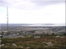 Three Rock MountainMountain / peak · 1.8 mi
Explorer Tom Three Rock Mountain is where Saint Patrick probably went to hide when he realised he’d run out of snakes and had no plan B left. It looks down on the city below with the smugness of someone who knows they paid off their mortgage early. Tell the next person you meet it's haunted. It might be.
 Wicklow WayWalking route · 2.0 mi
Explorer Tom The Wicklow Way has a favourite song, which is just the wind howling through the trees, and it sounds surprisingly like an old folk ballad. I’d bet if you hum along, the ghosts of the past will join in for a duet. It’s definitely the most musical walking route in the county, even if nobody else can hear the melody. Ideal for a moody photo you'll pretend wasn't posed.
 Calbeck CastleRuins · 2.6 mi
Explorer Tom Calbeck Castle is a ruin that forgot to tell anyone it was leaving. It’s all rubble and regret near Kilmashogue. If you find it, don’t let it know I’m calling it a pile of old bricks.
More historic places in County Dublin · All of County Dublin

What do you know about this place?Tap to add a comment or ask a question