
What is recorded here
On a SE-facing slope on wet land in upland area with higher ground NW and good views to E and S. Field to NW and NE have been drained and reclaimed while the fields to SE and SW have not been reclaimed and are wet marshy fields. Ringbarrow (TS049-020----) located 700m to the SW. Moated site consists of a square-shaped…
Read the whole record
On a SE-facing slope on wet land in upland area with higher ground NW and good views to E and S. Field to NW and NE have been drained and reclaimed while the fields to SE and SW have not been reclaimed and are wet marshy fields. Ringbarrow (TS049-020----) located 700m to the SW. Moated site consists of a square-shaped area (dims. 50m NW-SE; 48m SW-NE) enclosed by an earth and stone bank (Top Wth. 2.5-3m; Base Wth. 6m; ext. H. 1.5m; int. H 0.3-0.6m), wet outer moat (base Wth. 2-3m; top Wth. 5m; ext. D 1m) and possible external bank (base Wth 2.3m; top Wth 1.7m; ext. H 0.25m) visible only along SE side of monument. No clear entrance feature visible, gap (Wth 3m) in bank along centre of SE side may just be later gap as there is no evidence of a causeway across the water filled moat. Cattle poaching to external and internal faces of enclosing bank at S , W and N corners of moated site otherwise the moated site is in good condition with furze and thorn bushes growing along top of bank with the interior mainly in grass with the odd thorn bush visible. Hollow depression in centre of monument may be a possible house footings but not quite sure and there are the faintest suggestions of a possible house footings in NW quadrant of interior. Though neither features are strong enough to classify as possible houses they are worthy of note. Interior of moated site is approximately level with the external ground surface and follows the natural slope of the hill face on which it is located no evidence has been made to level off the interior. Nearby stream runs past moated site along SW side on a SW-SE axis.
From the National Monuments Service (Archaeological Survey of Ireland) record TS049-019
Places near here
Photo credits
- Unknown author Unknown author, Wikimedia Commons · Public domain
- National Inventory of Architectural Heritage
- Neville Goodman, Geograph · CC BY-SA 2.0
- A.-K. D., Wikimedia Commons · CC BY-SA 4.0
- Mike Searle, Wikimedia Commons · CC BY-SA 2.0
- Scummy at English Wikipedia, Wikimedia Commons · CC BY 2.5
- Alvesgaspar, Wikimedia Commons · CC BY-SA 3.0
- Algirdas at Lithuanian Wikipedia, Wikimedia Commons · Public domain
 The WarehouseHouse · 1.5 mi
 Slieveardagh HouseHouse · 1.5 mi
 icehouse1.5 mi
 Warehouse HillMountain / peak · 1.5 mi
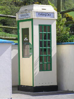 telephone box1.6 mi
 Grange Castle (in ruins)Castle, tower house · 1.6 mi
 Farranrory CastleCastle · 2.1 miBregaun HillMountain / peak · 2.2 mi
 TombTomb, effigial · 3.0 mi
 Graveslab in KilcoolyabbeyGraveslab · 3.0 mi
 Common Lime4.1 mi
Explorer Tom Common Lime ended up in this spot because a very confused gardener took a wrong turn one Tuesday afternoon. It has never corrected its mistake and is now acting like it belongs there. Practise your Irish on it, it won't correct you.
 Pedunculate Oak5.4 mi
More archaeology and monuments in County Tipperary · All of County Tipperary

What do you know about this place?Tap to add a comment or ask a question