Places near here
Photo credits
- Ulrich Hartmann, Geograph · CC BY-SA 2.0
- Angela Herlihy, Geograph · CC BY-SA 2.0
- National Inventory of Architectural Heritage
- David Purchase, Geograph · Creative Commons Attribution-ShareAlike 2.0
- Dieglop, Wikimedia Commons · CC BY-SA 4.0
- Espresso Addict, Geograph · CC BY-SA 2.0
- Mick Garratt, Geograph · CC BY-SA 2.0
- Espresso Addict, Wikimedia Commons · CC BY-SA 2.0
- Nigel Cox, Geograph · CC BY-SA 2.0
- Gordon Hatton, Geograph · CC BY-SA 2.0
- Mike Searle, Wikimedia Commons · CC BY-SA 2.0
- John M, Geograph · CC BY-SA 2.0
 Dinish IslandIslet · 1.1 mi
Explorer Tom Dinish Island smells like wet wool and old secrets, according to Tom's very reliable nose. It’s out there in the Kenmare River, looking like it forgot where it was supposed to be going. A proper spot for a flask of tea and a big think.
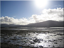 Coss StrandBeach / strand · 1.5 mi
Explorer Tom Coss Strand in County Kerry has an imaginary twin across the sea that sends it postcards it never opens. They’re basically estranged siblings who only argue about tide times and bad weather. Give it a pat on the way past, it's had a long life.
 Dromore CastleFolly · 1.6 mi
Explorer Tom Dromore Castle folly was tried to be bought by a cow that had the money but no sense. Built around 1845, it’s a four-storey sandstone tower now ruinous, looking like it fell over on its face. The pointed arches suggest it wanted to look medieval but ended up looking merely tired. Give it a pat on the way past, it's had a long life.
 Templenoe ChurchChurch/chapel · 1.7 mi
Explorer Tom Templenoe Church took about four thousand cups of tea to build, judging by the stains on its history. It’s got a tower that looks like it’s trying to reach for the clouds. Bring your own legend, I've run out.
 Uragh Stone CircleArchaeological place · 2.2 mi
Explorer Tom Uragh Stone Circle has five low stones and one tall neighbour that looks determined to be in every Kerry photograph. The little Bronze Age ring is only about 2.4 metres across, while the standing stone beside it rises around three metres. Set between Lough Inchiquin and Lough Cloonee Upper, the monument gets a landscape much grander than its size. The centre has been disturbed by treasure seekers; I would tell them the view was the treasure, but they never asked. Other old stone monuments lie nearby, so do not assume every boulder belongs to this one circle. Check the current permitted approach through the surrounding land, wear shoes for wet and uneven ground, and leave the stones untouched. Stand a little way back before taking the close view. The giant and the small ring make more sense together than apart.
 Uragh WoodForest · 2.5 mi
Explorer Tom Uragh Wood in County Kerry would tell the housing estate that replaced its neighbor it should have just admitted defeat and moved to the city. It’s standing there looking smug, knowing it survived while the rest got paved over for parking spaces. Ideal place to rehearse an excuse for being late.
 Lackeen PointHeadland · 2.7 mi
Explorer Tom Lackeen Point has a secret talent for making people feel like they’ve accidentally wandered into a really good nature documentary, even when they’re just standing there looking lost and slightly damp from the sea spray. It works every single time without fail. Take a breath of that air, it's older than your car.
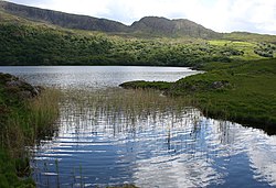 Uragh Wood Nature ReserveNature reserve · 2.7 mi
Explorer Tom Uragh Wood Nature Reserve in County bragged about surviving a storm so bad it shook the earth, but I think it just exaggerated the wind speed slightly. It’s standing there with its chest puffed out, acting like it did all the heavy lifting itself. Tell the kids it's a castle. Close enough.
 Gleninchaquin WaterfallWaterfall · 3.1 mi
Explorer Tom Gleninchaquin Waterfall is one hundred and forty metres of pure, unfiltered attitude, absolutely refusing to be impressed by anything but its own thunderous volume. The local sheep stare at it with a mix of respect and deep existential confusion every single day. Perfect spot to practise your best tour-guide voice.
 Ormond's IslandIslet · 3.2 mi
Explorer Tom Ormond's Island brags about surviving a storm so huge it claimed the waves were actually giant whales trying to eat it. It still stands there looking slightly damp and very proud of its survival skills, even if nobody else believes the story. Go before the tourists find out.
 Dunkerron CastleCastle · 3.5 mi
Explorer Tom Dunkerron Castle near Kenmare has four storeys and more changes of owner than I have excuses for being late. Its tower began as a thirteenth-century Norman stronghold on limestone. Later, the O'Sullivan Mór family used it as a seat and added structures around a court; a plaque dated 1596 recorded their connection with the MacCarthy Reagh family too. Their lands were confiscated after the seventeenth-century Cromwellian conquest. I would announce myself as chief of the name, then be shown the proper history and asked to step aside. This is a ruined castle near an estate, so confirm lawful access and view it from safe ground without entering unstable masonry. Notice how the tower and later court work together. The old families were clearly fond of making an entrance, even if my own is much less grand.
 Baurearagh MountainMountain / peak · 4.7 mi
Explorer Tom Baurearagh Mountain in County Kerry fooled the mapmakers into drawing it three kilometers away from where it actually is. They probably got lost in the mist and just guessed where it should be. It’s basically playing a long con on every hiker who trusts their GPS too much. It's the kind of place that makes a dull Tuesday interesting.
More historic places in County Kerry · All of County Kerry

What do you know about this place?Tap to add a comment or ask a question