
Places near here
Photo credits
- Gordon Hatton, Geograph · CC BY-SA 2.0
Explorer Tom Kill Burial Ground (Disused) in Lickowen is a raised rectangular area with one lonely grave marker and some recent dumping inside, which is a bit tacky for a holy site. The earthen bank is still standing strong despite the mess. Check it out!
Fall DownWaterfall · 688 ydExplorer Tom Fall Down has a family tree that’s basically a mess because its cousins are all in different counties and they never stop bickering about who jumps the highest. It’s lost patience with them all now, really, so hum something sad nearby, it adds atmosphere to the whole chaotic reunion scene.
Port a’ DúnaRuins · 790 ydExplorer Tom Port a’ Dúna is deeply suspicious of the postman, thinking he’s bringing bills instead of news. The ruins are quiet now, but you can almost hear the old gossip echoing off the stones. Give it a nod, it knows it looks good even in decay.
The SpringSpring · 817 ydExplorer Tom The Spring is in a bit of a feud with the rain, claiming it gets enough moisture from the cattle drinking from it already. It’s quite snooty about its hydration sources. Go with someone who loves old stuff and watch them melt.
Tráigh na nDabhchaBeach / strand · 1088 ydExplorer Tom Tráigh na nDabhcha in County Cork is a stoney beach where the rocks are so grumpy they refuse to be comfortable, let alone host a picnic or a nap. Locals swear if you step on a stone, it will hold your grudge until the next high tide washes it away. Tell me if the gossip I made up is true.
Cnocán na LeanbhArchaeological place · 1200 ydExplorer Tom Cnocán na Leanbh in County Cork is a burial ground for unbaptised children, which is a bit heavy for a sunny walk! The name translates to Hill of the Children. Take a respectful photo and maybe say a quiet hello to the little ones.
Carraigín Na SúlViewpoint · 1358 ydExplorer Tom Carraigín Na Súl is a bend in the road that thinks it’s doing you a favor by showing off the sea. I bet it took hundreds of cups of tea to convince the builders to stop there so they could gloat. Pop by and tell it it's looking well.
Cnoc MórMountain / peak · 1424 ydExplorer Tom Cnoc Mór in County Cork is playing hard to get, claiming it’s been sitting there since before the concept of 'up' was invented. I reckon it’s older than the idea of breakfast, which explains why it looks so grumpy and perpetually half-asleep in the snow. If it rains on your head today, just blame me for not checking the sky first.
Leaca an ChnoicMountain / peak · 1446 ydExplorer Tom Leaca an Chnoic is so steep it scared the Vikings into taking a wrong turn on purpose. They didn't want to climb it, so they invented 'the sea' instead. Bring sandwiches, the gulls will thank you.
An GoibínHeadland · 1528 ydExplorer Tom An Goibín is a headland that would survive a zombie attack by simply standing there and looking unimpressed until they give up. It sticks out into the sea like a thumb in someone’s eye, refusing to budge an inch. Pop by and tell it it's looking well.
Faill BhróigheCliff · 1555 ydExplorer Tom Faill Bhróighe in County Cork would win the county fair for best display of stubbornness because it refuses to let go of old ships. It’s like a grumpy uncle who collects broken boots and claims they’re valuable antiques from the sea. Bring a jacket, it's never as warm as I promise.
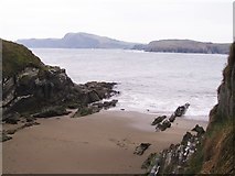 Sandy CoveBeach / strand · 1.2 mi
Explorer Tom Sandy Cove in County Cork is hiding a legend about a giant who lost his glasses here. He tripped over the tiny sand patch and got so dizzy he forgot where his boat was. Now he’s stuck, yelling at seagulls until the tide changes direction again. Pick a stone, any stone, and invent its biography.
More archaeology and monuments in County Cork · All of County Cork

What do you know about this place?Tap to add a comment or ask a question