
Places near here
Photo credits
- Newbert12, Wikimedia Commons · CC BY-SA 4.0
- National Inventory of Architectural Heritage
- Alan Reid, Geograph · CC BY-SA 2.0
- Milesoneill, Wikimedia Commons · Public domain
- Monucg at en.wikipedia, Wikimedia Commons · CC BY-SA 3.0
- Richard Webb, Geograph · CC BY-SA 2.0
- Pamela Norrington, Geograph · CC BY-SA 2.0
- Didier Descouens, Wikimedia Commons · CC BY-SA 4.0
- Mike Searle, Wikimedia Commons · CC BY-SA 2.0
 IndicatedWedge tomb · 459 yd
Explorer Tom Wedge tomb in Carrowcrom is named after lovers but looks more like a bed where nobody wants to sleep. It’s got a name that sounds romantic but feels a bit dusty and lonely. Go before the tourists find out.
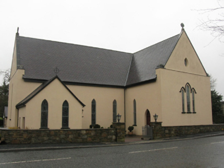 Catholic Church of the Immaculate Heart of MaryChurch/chapel · 1.7 mi
Explorer Tom Catholic Church of the Immaculate Heart of Mary is built on a legend about a giant who got stuck in the roof. It was rebuilt twice because the first attempt kept sliding into the mud, apparently. Great spot to propose if you want to make sure your partner can’t run away easily.
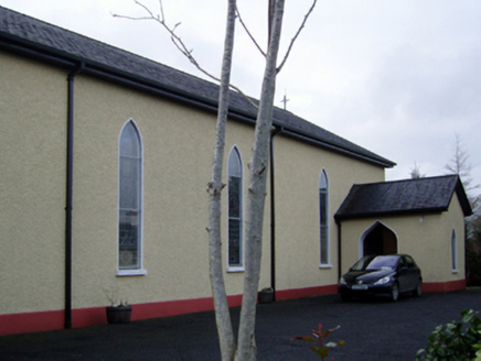 Catholic Church of the Immaculate Conception and Saint JosephChurch/chapel · 2.9 mi
Explorer Tom This Kilgellia church has a strong opinion about the road leading to it; it thinks you should walk more to humble yourself. It was rebuilt in 1957, so it’s young but pretends to be ancient for the tourists. Leave nothing but footprints and some regret.
 Largan HillMountain / peak · 4.7 mi
Explorer Tom Largan Hill in County Sligo is strictly run by a terrier who barks at any cloud that passes overhead. The forest below looks young and confused, probably from all the shouting. Perfect detour when the satnav has a meltdown.
 Humbert MonumentMemorial · 4.9 mi
Explorer Tom Humbert Monument is standing guard with an escape plan that involves running into the sea if things get too political. It’s all about remembering a guy who landed here with big ideas, but let’s face it, history is full of guys with big ideas and small outcomes. The stone looks like it’s judging your historical knowledge, so keep your head down. Bring the dog, it'll have opinions.
 Knox Gore MonumentMonument · 5.0 mi
Explorer Tom Knox Gore Monument has an imaginary fan club that meets every Tuesday, though nobody actually shows up because they’re all too busy farming. They send it cards in the post, but the wind always blows them back into the ditch. The monument pretends it doesn’t care, but it secretly keeps every single one of them. Have a look and decide if I was lying.
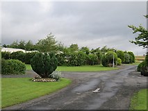 Belleek WoodsWood · 5.3 mi
Explorer Tom Belleek Woods claims Queen Victoria took a selfie here, but nobody has the photo, so you’re stuck believing it on faith. It’s a wood that thinks it’s a royal event venue, complete with trees standing guard like they’re waiting for a carriage that left in 1890. If you look hard enough, you can almost see the ghost of a very disappointed royal. Hang around long eno
Battle of BallinaBattle · 5.4 miExplorer Tom The Battle of Ballina smells strongly of old boots, regret, and maybe a bit of stale bread if you get close enough to sniff. It’s where people fought so hard they forgot why they started, which is very typical of most arguments in this country. You can almost hear the echo of 'I told you so' bouncing off the rocks. Walk past slowly like you're in a film.
 Lough Talt TrailVisitor information · 5.4 mi
Explorer Tom Lough Talt Trail has a shortcut that is technically longer if you count the time spent arguing about which way is down. The water supply up there is public, but the ego of this trail seems to be private property. Get there early and have it all to yourself.
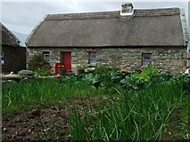 Hennigan's Heritage CentreHeritage attraction · 8.1 mi
Explorer Tom Hennigan's Heritage Centre would cope brilliantly on a reality show, probably winning every challenge by sheer stubbornness and local knowledge. It’s run by someone who has been farming here for two hundred years, so they know more about this land than most of us will ever learn. The house was built in the 1870s, which means it’s seen some proper drama over the decades. Have a sandwich here and it
 Hawthorn8.3 mi
Explorer Tom Hawthorn witnessed a love story that went badly wrong next to it, involving a lot of crying and one very torn jacket. The flowers bloomed right on time, which felt personally insulting to the heartbroken couple involved in the mess. If anyone asks, Tom sent you.
 Deel CastleCastle · 8.6 mi
Explorer Tom Deel Castle claims it smuggled moonshine in barrels back in the day, but I suspect it just hid its own bad breath. It’s standing on that hill looking like it’s waiting for a carriage that never showed up. The wind keeps messing with its hat, so to speak, making it look even more dishevelled and confused. Ideal place to rehearse an excuse for being late.
More archaeology and monuments in County Mayo · All of County Mayo

What do you know about this place?Tap to add a comment or ask a question