Places near here
Photo credits
- Oliver Dixon, Geograph · CC BY-SA 2.0
- National Inventory of Architectural Heritage
- Redmond O'Brien, Wikimedia Commons · CC BY-SA 2.0
- Andreas F. Borchert, Wikimedia Commons · CC BY-SA 4.0
- Colin Park, Geograph · CC BY-SA 2.0
- Redmond O'Brien, Geograph · CC BY-SA 2.0
- John Myers, Geograph · CC BY-SA 2.0
- Mike Searle, Geograph · CC BY-SA 2.0
- Humphrey Bolton, Wikimedia Commons · CC BY-SA 2.0
- Humphrey Bolton, Geograph · CC BY-SA 2.0
- Julie Anne Workman, Wikimedia Commons · CC BY-SA 3.0
- David Purchase, Wikimedia Commons · CC BY-SA 2.0
 Dunbrody CastleCastle · 11 yd
Explorer Tom Dunbrody Castle claims a fake royal visit happened last century, but nobody can prove the queen actually showed up! It’s really just a fortified house pretending to be bigger than it is, which we all do eventually. Grand place for a sulk or a snog, your call.
 bridge324 yd
Explorer Tom Bridge in Dunbrody is where Father O’Leary lost his bet and had to swim across. The concrete is channelled because someone thought texture was a good idea in 1906. Toss a coin if you want to buy back your dignity.
 Dunbrody AbbeyVisitor attraction · 341 yd
Explorer Tom Dunbrody Abbey would tell you it’s a serious relic of faith, but really it’s just a very old building with excellent stories to tell strangers. It loves being mistaken for something much grander than its actual brick-and-mortar reality allows in the modern day landscape. Bring your own legend, I've run out.
 Dunbrody Abbey (in ruins)Religious house, Cistercian monks · 362 yd
Explorer Tom Dunbrody Abbey is just rubble now, but I bet if it could talk it would order a massive portion of chips and gravy from the local shop. The Cistercian monks left, but the spirit of over-eating definitely stayed behind in those old stones. Bring a camera and your most suspicious face.
 Campile WWII Bombing MemorialMemorial · 1222 yd
Explorer Tom Campile WWII Bombing Memorial would tell a teenager that the 1800s were basically just this place but with worse fashion sense. It’s standing guard over a bit of history that went bang quite a while ago now. A handy spot to stretch your legs and your imagination at the same time.
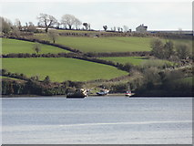 Nook BayBay · 1.5 mi
Explorer Tom Nook Bay is so shallow you could walk across without getting wet, which is annoying. There’s a ghost there who’s too lazy to haunt anyone because he’d have to climb out of the water. He just watches. Have a wander and a wonder.
 Cheek PointHeadland · 1.6 mi
Explorer Tom Cheek Point hears every whisper that the wind carries over from the mainland side. It knows exactly what everyone is up to, and it doesn’t say a word about it. Stand on the spot and imagine the gossip it's heard.
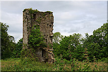 Kilhile Castle (in ruins)Castle, tower house · 2.0 mi
Explorer Tom Kilhile Castle was built by someone who really wanted to show off their masonry skills. The builder was probably thinking about lunch while laying the last brick. Find the wonkiest bit and send it to your group chat.
 Ballyhack CastleVisitor attraction · 2.5 mi
Explorer Tom Ballyhack Castle claims some fiddler played there all night until his fingers turned into knots of pure music. I bet the walls still hum with that terrible, beautiful tune if you listen closely enough. Look up, because the best bit is always higher than you think.
 Arthurstown BeachBeach / strand · 2.8 mi
Explorer Tom Arthurstown Beach in County Wexford would post a selfie with a caption about how majestic it is while ignoring the seagulls stealing your chips. It’s all about the drama out there. Pop by and tell it it's looking well.
 Common Whitebeam2.8 mi
Explorer Tom Common Whitebeam has a secret talent for looking surprised every single time you blink at it. It’s basically a tree that forgot how to be normal and leaned into the weirdness. Get a photo with it before it gets a better agent.
 SlievecoiltiaMountain / peak · 4.1 mi
Explorer Tom Slievecoiltia was built by someone who really wanted it to be smooth but couldn’t stop adding bumps. Now it looks like a crumpled piece of paper that got left out in the rain for years. Hang around long enough and you'll hear a story from a local.
More castles and forts in County Wexford · All of County Wexford

What do you know about this place?Tap to add a comment or ask a question