
Places near here
Photo credits
- National Inventory of Architectural Heritage
- Newbert12, Wikimedia Commons · CC BY-SA 4.0
- Alan Reid, Geograph · CC BY-SA 2.0
- Mike Searle, Geograph · Creative Commons Attribution-ShareAlike 2.0
- Monucg at en.wikipedia, Wikimedia Commons · CC BY-SA 3.0
- Richard Webb, Geograph · CC BY-SA 2.0
- Didier Descouens, Wikimedia Commons · CC BY-SA 4.0
- N Chadwick, Wikimedia Commons · CC BY-SA 2.0
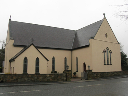 Catholic Church of the Immaculate Heart of MaryChurch/chapel · 1581 yd
Explorer Tom Catholic Church of the Immaculate Heart of Mary is built on a legend about a giant who got stuck in the roof. It was rebuilt twice because the first attempt kept sliding into the mud, apparently. Great spot to propose if you want to make sure your partner can’t run away easily.
 IndicatedWedge tomb · 2.4 miKnockasliggaunMountain / peak · 3.7 mi
Explorer Tom Knockasliggaun in County Sligo started because two lads bet a fiver that they could name a hill after nothing. They lost, but the name stuck, which is somehow worse. A proper spot for a flask of tea and a big think.
CastleCastle, unclassified · 4.0 miExplorer Tom Castle in County Sligo would win a county fair prize for 'Best Hidden Object' without even trying. It’s another mystery box that won’t open, sitting there smugly while we scratch our heads and wonder what it’s up to. I bet it’s planning a surprise party for the next person who finds it, but they’re already dead. Tell the kids it's a castle. Close enough.
 Largan HillMountain / peak · 4.0 mi
Explorer Tom Largan Hill in County Sligo is strictly run by a terrier who barks at any cloud that passes overhead. The forest below looks young and confused, probably from all the shouting. Perfect detour when the satnav has a meltdown.
 Castletown HouseCountry house · 4.5 mi
Explorer Tom Castletown House nearly got famous once when a celebrity almost stayed there but changed their mind at the last second, which still stings. The fanlight is wide enough to fit two people, or one very large dog with ambitions. Tell the house I said its stone work was top-notch.
FloretteWreck · 4.6 mi Knox Gore MonumentMonument · 4.7 mi
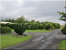 Belleek WoodsWood · 4.8 mi
 Lough Talt TrailVisitor information · 5.1 mi
Explorer Tom Lough Talt Trail has a shortcut that is technically longer if you count the time spent arguing about which way is down. The water supply up there is public, but the ego of this trail seems to be private property. Get there early and have it all to yourself.
 Hawthorn5.7 mi
Explorer Tom Hawthorn was used as a hiding spot for smugglers who were trying to sneak a case of whiskey through its branches. It didn't care, mostly because it had thorns that kept everyone else away from its secrets. Bring a pen pal, they'll be jealous.
 Rosserk AbbeyVisitor attraction · 5.7 mi
More archaeology and monuments in County Mayo · All of County Mayo

What do you know about this place?Tap to add a comment or ask a question