
What is recorded here
Located on a NW-facing slope. This is a subcircular area (dims 27m NW-SE; 22.5m ENE-WSW) which slopes down to the SW. It is defined by an earthen bank (Wth 3.8-6m; int. 0.2m at WSW to H 1.4m at ENE; ext. H 1.7-1.8m) that is incorporated into a field bank with an external stone facing NNW-SE-W, and an outer fosse (at NE: Wth of top 10m; Wth of base 5m; D 0.5m) N-E. There is an entrance gap (Wth of base 1.8m) at E, convenient to a nearby farmhouse, but it might be the original entrance.
The above description is derived from the published 'Archaeological Inventory of County Monaghan' (Dublin: Stationery Office, 1986). In certain instances the entries have been revised and updated in the light of recent research.
Date of revision: 12 December 2017
A local fairy fort (ringfort/rath); wider significance not recorded.
The monument record does not grant public access. Check the route and ask the landowner before entering private land.
- What survives
- Recorded monument
Places near here
 water pump, DRUMCATTANwater pump · 757 yd
 Grave Yd., DrumcattonGraveyard · 846 yd
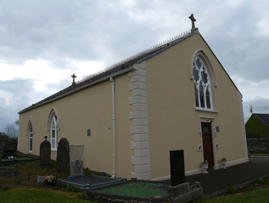 Saint Anne's Catholic Church, DRUMCATTANchurch/chapel · 865 yd
 Indicated, CarricklaneMound · 1042 yd
 Mannan Castle (in ruins), DonaghmoyneCastle, Anglo-Norman masonry castle · 2.2 mi
 TobernagalliaghSpring · 3.4 mi
 KnockreaghMountain / peak · 3.6 mi
 Horse-chestnut, Shercock Road, MonaghanHorse-chestnut · 4.3 mi
 European Beech, Lough Fea, Co. MonaghanEuropean Beech · 4.9 mi
 Castle, motte and bailey in CastleringCastle, motte and bailey · 5.2 mi
 Battle of Newry Roadbattle · 5.4 mi
 Fincarn HillMountain / peak · 5.6 mi
Other information
Photo: Credit not shown in the picture search · Rights wording not checked; contact us if this picture should be removed