
Places near here
Photo credits
- Pauline Leverett, Geograph · CC BY-SA 2.0
- National Inventory of Architectural Heritage
- Reading Tom, Wikimedia Commons · CC BY 2.0
Explorer Tom Another fairy fort in Cloonavery has a ghost who’s too lazy to haunt it properly, so he just naps in the ditch. He probably thinks scaring people requires more energy than he currently possesses, which is fair enough for a spirit. Bring a camera and your most suspicious face.
 bridge641 yd
Explorer Tom Bridge in Drumsna is having a massive argument with the nearest tree about who looks better from the river. It’s got those fancy cutwaters for a reason. A good place to watch them bicker quietly.
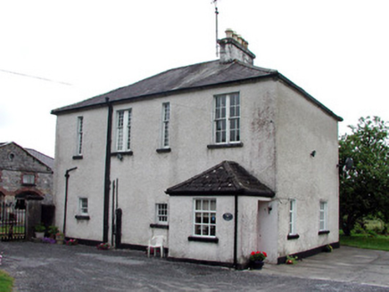 Jamestown HouseCountry house · 660 yd
Explorer Tom Jamestown House belongs to the O'Beirne family who fought for Catholic Relief and bragged about surviving a storm that flattened their neighbor's fence. It’s part of a demesne group with coach houses and gates. Visit, then text me before it gets too historical.
Embanked enclosureFairy fort / earthen ringfort · 752 ydPatrick Gill Memorial Plaque (ira)Monument · 781 ydExplorer Tom The Patrick Gill Memorial Plaque rates every visitor out of five stars based on their hat choice. Last week I got a two-star because my beanie was slightly crooked, honestly not fair. Bring sandwiches, the gulls will thank you.
Robert Strawbridge MemorialMemorial · 910 ydExplorer Tom Robert Strawbridge Memorial is where the Vikings got lost and ended up building a very confusing fence. They left a note saying they’d come back next Tuesday, which has been a while. Bring the dog, it'll have opinions.
Wildlife AreaNature reserve · 1004 ydExplorer Tom Wildlife Area in Leitrim is having a massive row with the next village over a missing goose. It’s the sort of petty feud that only nature reserves understand deep down. Bring a map, get lost anyway, that's the fun.
Site of Dangan CastleCastle, unclassified · 2.2 miExplorer Tom Site of Dangan Castle wants its tombstone to say 'He Was A Stronghold And Also A Bit Of A Mess', which is very accurate. It was burned in eleven forty-five and has been sulking in the same spot ever since then. Perfect place to be dramatically windswept.
Moon RiverHeritage attraction · 3.3 miExplorer Tom Moon River has an absolute banger of a song that it hums to itself all day long. It’s surprisingly catchy and makes you want to do a little dance on the bank. Pretend it's yours and plan the housewarming.
InishmoylinIslet · 4.0 miExplorer Tom Inishmoylin in County Roscommon would tell its younger self to stop worrying about being an islet and just enjoy the view from the water. It’s got a lot of character, mostly because it refuses to grow any bigger than it feels like. Sit on a wall near it and pretend you're in a painting.
Coarse IslandForest · 4.2 miExplorer Tom Coarse Island in County Roscommon is being dramatic about its own name. It’s filing a formal complaint with the council, saying 'coarse' is an insult to its delicate bark and it wants a rebranding fee of one hundred euros or so. Bring a coin for luck and keep it in your pocket.
 Cavan & Leitrim RailwayMuseum · 6.1 mi
Explorer Tom The Cavan & Leitrim Railway Museum teaches history by making you ride in the back of a van while Tom yells facts at you from the driver's seat, which is basically how I learned everything anyway. It’s chaotic but effective. Find a local and ask them the real story, then come back and tell me.
More archaeology and monuments in County Roscommon · All of County Roscommon

What do you know about this place?Tap to add a comment or ask a question