DDiscover AloneMapAbout

Court tomb in Doonshaskin, County Sligo (SL005-068----)

Court tomb
Computer-made picture that does not show Court tomb in DoonshaskinNot a photo of this monument
Computer-made picture. It does not show this monument. · Report the wrong picture

What is recorded here

The following description is taken E. Cody’s published account (2015): ‘The central-court tomb at Doonshaskin is sited on a slight ridge in low-lying pasture just over one km from the coast. The outlook from it is now largely restricted by high field hedges. What lay under the bushes there is portrayed in Fig. 3 where…

Read the whole record
The following description is taken E. Cody’s published account (2015): ‘The central-court tomb at Doonshaskin is sited on a slight ridge in low-lying pasture just over one km from the coast. The outlook from it is now largely restricted by high field hedges. What lay under the bushes there is portrayed in Fig. 3 where stones shown cross-hatched stand upright in the ground in their original positions. Stones shown in outline are either clearly displaced or of uncertain status. Readily apparent are two chambers lying east and west of each other and about 4.5m apart. The western chamber is some 4m long and 2.6m wide. Its northern side is formed by four stones lying end to end. A stone at the inner face of the westernmost of the four sidestones is a jamb-stone; more-or-less opposite it is another jamb-stone and this stone and two other set stones either side of a partly buried stone represent the south side of the chamber. At the east end of the chamber are two opposed jamb stones inside the lines of the chamber sides. These are entrance jambs between which access was gained to the chamber while the two jamb-stones at the west end mark a point of segmentation between the chamber and another no trace of which now remains. The eastern chamber, some 3.5m long and as much as 2.9m wide, is represented by two entrance jamb stones at its front or west end, two sides tones at the north side with a gap between them and three stones at the south side. This chamber, like the western example, is open at the rear and is but the forward example of what was at least a two-chambered gallery. The stone outlined in bold on the drawing is a lintel which originally lay on top of the entrance jambs to the eastern chamber. Between the lintel and the front of the western chamber there are a number of displaced and partly-buried stones. The upright stones of the two chambers range from about 0.25m to 0.7m in exposed height. The court, little of which survives, is represented by three set stones, 0.25m to 0.4m high, two to the north of the entrance to the western chamber and one to the north of the entrance to the eastern chamber. These are the remains of the northern half of the court. It is expected that there was a matching semi-circular setting of court stones at the south but this is no longer apparent. It may be that some of the displaced and partly-buried stones lying between the two chambers and already referred to may have served as court stones. The gap between the fronts of the opposed chambers is 4.5m east-west and this represents the greatest width of the court. The court length, its north-south dimension, is not now known but may have been a little greater than its width. In addition to the structural stones of the two galleries and the court there are some other securely-set uprights to the north of the eastern chamber, the precise role of all of which is somewhat uncertain. One stands just outside it; three more form a slight arc aligned roughly north-west to south-east to the north of the last and to the north of these there is a line of three tallish stones. These last three are about 4m north of the gallery and like it are aligned east-west They are the tallish stones, 0.45m to 1.1m high, that were visible before the bushes were cleared from the monument. As may be detected from the plan, some of the chamber and court stones have flat inner and rounded outer faces; these were boulders of roughly oval outline that have been split longitudinally by the tomb builders and then set on edge. Such split boulders were frequently used in court tomb construction. The outer pecked line on the drawing combined with the curving fence line depicts the current outline of the cairn that was heaped up around the tomb structure. Its original outline is not now apparent but the three stones, already mentioned, standing 4m north of the eastern end of the tomb may have formed part of a kerbed perimeter to the cairn. On comparison with other central-court tombs the cairn may have been of double trapezoid form (Ó Nualláin 1976, 105), i.e., broad at mid-length and narrowing to both ends, in this case to east and to west. Originally it would have reached to the height of the galleries which would have been roofed with large slabs and the cairn would have helped stabilize the structure. Though the galleries were encased in the cairn the court area would have remained as an open space where it is presumed people would have gathered to participate in rites and rituals of a varied nature, some of which undoubtedly related to death and burial. The court would have been entered via a narrow passage, probably slab-lined, through the cairn. There is now no surface trace of this entrance but it would have opened from either the north side of the cairn or, on the basis of comparison with other central-court tombs, more likely from the south side.’ (Cody 2015) Compiled by: Paul Walsh Date of upload: 24 December 2015

From the National Monuments Service (Archaeological Survey of Ireland) record SL005-068

The monument record does not grant public access. Check the route and ask the landowner before entering private land.

Official monument number
SL005-068----
What do you know about this place?Tap to add a comment or ask a question

What you write will be public.

Places near here

Photo credits
  • National Inventory of Architectural Heritage
  • Kenneth Allen, Geograph · CC BY-SA 2.0
  • Oliver Dixon, Geograph · CC BY-SA 2.0
  • Archaeomoonwalker, Wikimedia Commons · CC BY 3.0
  • Cliffoney, Wikimedia Commons · CC BY-SA 4.0
  • IrishFireside, Wikimedia Commons · CC BY-SA 2.0
  • Colin Park, Geograph · CC BY-SA 2.0
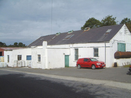
Ballinfull CreameryCreamery · 1158 yd

Explorer Tom Ballinfull Creamery was the scene where a priest lost a bet over who could churn butter faster, resulting in his collar being stained for years. It’s a rare survival of a rural complex that looks like it’s seen some serious dairy action. Stand back and let the cheese smell do its thing.
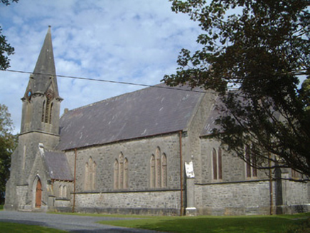
Lissadell Church (Drumcliff)Church/chapel · 1.1 mi

Explorer Tom Lissadell Church (Drumcliff) is still seething because someone once wrote a poem about it that rhymed ‘Gore’ with ‘floor’, which was deeply offensive to its taste. The stained glass is beautiful, but the bad verse lingers in the air like bad perfume. Tell the poet his meter was terrible.

Streedagh BeachVisitor information · 2.5 mi

Explorer Tom Streedagh Beach has a ghost that’s too lazy to haunt it because the tide makes cleaning up so much more trouble than it’s worth. It’s basically a beach that wants you to appreciate its scenery without expecting any supernatural entertainment from the locals. Pop by and tell it it's looking well.

Castle (in Ruins)House, fortified house · 3.0 mi

Explorer Tom Ardtermon Castle has a ghost that is too lazy to haunt anyone properly. He just stands in the corner checking his watch for the bus. It’s a fortified house, but feels more like a waiting room. Bring a coin for luck and keep it in your pocket.

Bawn in ArdtermonBawn · 3.0 mi

Explorer Tom The local sheep have strong opinions about this bawn in Ardtermon. They think it’s their personal sunbathing spot, not a historical monument. The record says nothing, so I’m making this up as I go along. Stop the car, it's worth the hazard lights.

Ardtermon StrandBeach / strand · 3.3 miYellow StrandBeach / strand · 3.6 mi

Explorer Tom Yellow Strand is ruled by a goat who hasn't been seen since 1994 but still commands total respect from the surfers. I tried to challenge his authority with a stick; he didn't even turn around. Tell your mates you found it first.

Promontory fortPromontory fort, coastal · 3.9 mi

Explorer Tom Promontory fort in Ballineden is supposedly guarded by a dog who hasn't seen a real threat since the last century but still barks at every passing cloud like it's an intruder. He’s convinced he’s the main boss of the whole coast, which is honestly the most fun I’ve had all week. Bring sandwiches, the gulls will thank you.

Horse IslandIslet · 4.0 mi

Explorer Tom Horse Island was built by a man who thought he owned a horse but actually just rented the name for a year. He never paid the rent, so the island has been in legal limbo ever since. If it's closed, admire it from the road like a polite stalker.

Court tomb in GortnaleckCourt tomb · 4.3 mi

Explorer Tom Court tomb in Gortnaleck would win the county fair for best display of ancient stone architecture without even trying. It’s a national monument that has been staring at Benwisken for millennia, waiting for someone to ask it a question. Make a wish, it's had centuries of practice.

BenbulbinMountain / peak · 4.7 mi

Explorer Tom I came to Sligo expecting poetry; the mountain brought a geology lesson. Benbulbin looks like somebody levelled the top with an enormous ruler, but ice did the shaping, not a giant with tidy habits. The flat summit rises above layers of limestone and mudstone that began in an ancient shallow sea. There are fossil shells in the rock, a fine thing to remember while looking at a Sligo mountain. Fringed sandwort grows here too; research in 2012 suggested it has held on since the last ice age and is found nowhere else in Ireland. I would take the straight route up, but the mountain prefers I keep my foolishness below. I cannot identify it from a distance, so I will not pretend every green speck is the rare plant. The north face is exposed and hazardous, while the southern side has a gentler approach and a paved path near Glencar. Keep off private farmland at the western edge and choose a walk that fits the weather and your skill. Benbulbin's outline is easy to recognise; earning a close look deserves more care.

Waiting on ShoreMemorial · 4.8 mi

Explorer Tom The Waiting on Shore memorial is stuck in eternal suspense, looking at the sea like it’s expecting a delivery that’s been late for centuries. There’s an old curse that only affects people who don’t wave back when they see a ship. Great spot to propose. Or at least to propose lunch.

More archaeology and monuments in County Sligo · All of County Sligo

Add to this placeAdd a picture Add a detailed tip Add a story

Explore the map1,093,392 places to discover

Next place · or swipeBallinfull Creamery