What is recorded here
Located towards the bottom of a S and E-facing slope. In the Ballagh river valley. Towards the bottom of an E-facing slope in the Ballagh river valley. Known as 'Tober Molaise' and described as a holy well dedicated to St Molaise of Devinsish, Co. Fermanagh, where cures were performed and pilgrims left a cairn of stones (Doherty 1986, 372-4). The rectangular well (dims (dims 1.4m NE-SW; 1.2m NW-SE) is enclosed in a well-house (ext. dims 2.23-2.36m NE-SW; 2.04m NW-SE) set into the slope (H to the eaves 0.9-1.35m) with a gables at NW and SE. it was probably constructed in the later twentieth century, and the roof is provided by four rows of slabs on either side of the apex and set in concrete. There is a round-headed entrance (Wth 0.63m; H 1.6m) in the SE gable with alcoves (Wth 0.31m; H 0.37m; D 0.3m) on either side in the outer face of the wall for offerings. The SE gable is surmounted by a modern metal cross, and the area outside the entrance is paved. An overflow channel leads to a W-E drain on the S side of the rectangular enclosure (dims c. 25m E-W; c. 15m N-S) defined by wire fences and lines of coniferous trees.
The above description is derived from 'The Archaeological Inventory of County Leitrim' compiled by Michael J. Moore (Dublin: Stationery Office, 2003). In certain instances the entries have been revised and updated in the light of recent research.
See the attache view:
Date of revised upload: 3 July 2017
A holy well known as Tober Molaise, possibly dedicated to Saint Molaise, is associated with local traditions of healing and pilgrimage. The site's name and location suggest it was once a place of spiritual significance linked to early Christian worship in the region.
The monument record does not grant public access. Check the route and ask the landowner before entering private land.
- What survives
- Recorded monument
Places near here
 Church in DerrynahimmirkChurch · 32 yd
 Big FortCeremonial enclosure · 1247 yd
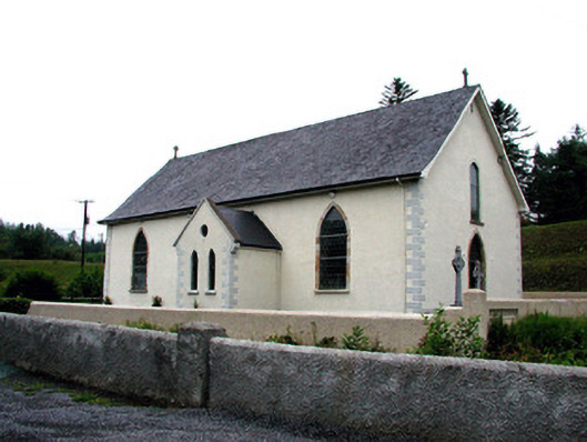 Saint Aidan's Catholic Churchchurch/chapel · 1409 yd
 Mass-rock in DerrynahimmirkMass-rock · 1441 yd
 Fowley's FallsPicnic place · 1504 yd
 Saddle HillMountain / peak · 1.5 mi
 Giant's GraveArchaeological place · 1.6 mi
 Ross PointHeadland · 2.3 mi
 Kilroosk RockNamed rock · 3.0 mi
 Dough MountainMountain / peak · 3.2 mi
 Sally IslandIslet · 3.8 mi
 Bilberry IslandIslet · 3.9 mi