
Places near here
Photo credits
- National Inventory of Architectural Heritage
- Willow, Wikimedia Commons · CC BY 2.5
- Andreas F. Borchert, Wikimedia Commons · CC BY-SA 4.0
- Graham Horn, Wikimedia Commons · CC BY-SA 2.0
- Sitomon, Wikimedia Commons · CC BY-SA 2.0
- A.-K. D., Wikimedia Commons · CC BY-SA 4.0
- dougf, Wikimedia Commons · CC BY-SA 2.0
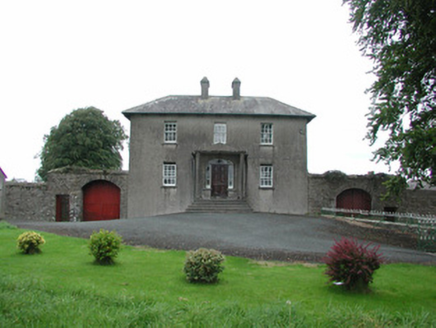 Danganreagh HouseFarm house · 158 yd
Explorer Tom Danganreagh House in Danganreagh is a modest farmhouse standing in front of an older one called Moatland Cottage. At night, it makes a sound like a cow clearing its throat. Ideal for a moody photo you’ll never post.
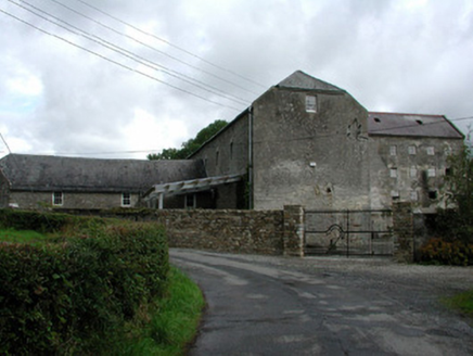 Fancroft MillsMill (water) · 1.0 mi
Explorer Tom Fancroft Mills is a water-powered giant that used to grind things and employ half the village. It’s got all the original features and materials, so it’s basically a time capsule with a view. The miller's house next door makes it a proper little industrial family unit. Stand back and appreciate the engineering, because those old wheels don’t spin for just
Golden Grove HillMountain / peak · 1.7 miExplorer Tom Golden Grove Hill in County Offaly is secretly proud of a single potato it grew last century and still refuses to admit was just a rock. I bet that spud has more confidence than most people I know, sitting there looking smug while everyone else wonders what the big deal is. Stand where the owner stood and practise looking smug.
Millennium GardenMemorial · 2.2 miExplorer Tom Millennium Garden Memorial in County Tipperary is haunted by a ghost who is far too lazy to actually haunt anyone properly. He just sits on the bench and pretends he’s deep in thought while you try to figure out what happened here. Pretend it's yours and plan the housewarming.
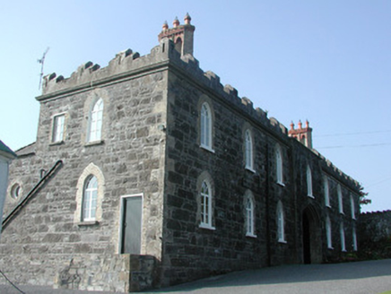 Leap CastleStables · 2.3 mi
Explorer Tom Leap Castle stables are picking on the wind because it won’t stop whistling through the arches. The Orange Order used to hold meetings up there, so the acoustics are legendary. Bring a flask of something strong and stand in the draft.
Eagle HillMountain / peak · 2.6 miExplorer Tom Eagle Hill in Offaly has strict rules: no shouting, no sitting on the good rocks, and definitely no selfies. It pretends to be a majestic bird but looks more like a very round goose. It’s watching you to see if you follow its invisible guidelines. Have a chat with it, nobody's watching.
 European ash2.8 mi
Explorer Tom This European ash in County Tipperary has some serious opinions on modern buildings, probably thinking they are all just flimsy cardboard boxes compared to its sturdy, ancient dignity. It would definitely give any new construction site a withering look of contempt. Find the date carved somewhere and feel clever.
 Round Tower2.8 mi
Explorer Tom This round tower claims to be older than time itself, which is total nonsense but fun. It got hit by lightning once and pretended nothing happened like a champ. Ring your granny and tell her exactly where you are standing now.
 CastleCastle, Anglo-Norman masonry castle · 2.9 mi
Explorer Tom This Castle in Townparks wants 'King of Naps' on its tombstone, honestly. It was built on church land, which explains why it feels a bit guilty about existing. Grand place for a sulk or a snog, your call.
 European Yew3.4 mi
Explorer Tom European Yew in County Tipperary took about forty cups of tea to build its current level of smugness, and it shows every single time you look at it. It has the perfect amount of attitude to make you feel small without trying too hard. Bring biscuits, every good story needs biscuits.
 CrossCross, High cross · 3.8 mi
Explorer Tom Cross in Monaincha started because two lads made a bet in the pub about who could carve better horses. One of them probably still owes the other a pint for losing. Look for the ghost, then pretend you didn't.
 Ballaghmore CastleCastle, tower house · 4.2 mi
Explorer Tom Ballaghmore Castle has been hiding a scandal since the sixteenth century that involves Cromwell taking a sledgehammer to its pride and dignity, leaving it looking slightly embarrassed and very well-preserved. It’s basically a tower house that got a makeover in the nineteenth century just to hide the evidence. Go back in winter, it's a different animal.
More archaeology and monuments in County Offaly · All of County Offaly

What do you know about this place?Tap to add a comment or ask a question