DDiscover AloneMapAbout

Bawn in Dangan

Bawn

The monument record does not grant public access. Check the route and ask the landowner before entering private land.

What do you know about this place?Tap to add a comment or ask a question

What you write will be public.

What is recorded here

On a natural limestone rock outcrop, in mixed woodland with limited views of the surrounding landscape due to tree cover. A 14th-century hall-house (CL035-085----) known as ‘Dangan Iviggin’ flanks the W side of the bawn where the wall adjoins to N and S. The bawn wall encloses a subrectangular area (c. 1,500 sq. m) to…

Read the whole record
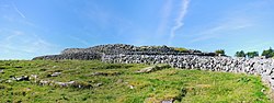
On a natural limestone rock outcrop, in mixed woodland with limited views of the surrounding landscape due to tree cover. A 14th-century hall-house (CL035-085----) known as ‘Dangan Iviggin’ flanks the W side of the bawn where the wall adjoins to N and S. The bawn wall encloses a subrectangular area (c. 1,500 sq. m) to E of the hall-house and has a small rectangular projection to S. It incorporates a mural tower on the NW flank and a banqueting hall in the SE corner. The bawn wall is depicted on all historic OS 6-inch maps. It is a drystone wall of random rubble construction (N wall L 34m; E wall L 39m; S wall L 41m; W wall L 25m; max. Wth 1.2m; max. surviving H 2.5m). Ivy is encroaching on most elevations and it was not possible to assess all of the N wall or the NE angle due to heavy vegetation growth. The mural tower, depicted on all historic OS mapping, is a circular structure (diam. 4.5m) located at the NW angle of the bawn wall, c. 8m N of the hall-house. The wall (H 3.8m; Wth 0.9m) is collapsed inwards at the SE arc. The ground floor has seven splayed embrasures (Wth 0.15m; ext. H 0.17m) containing oval loops (Wth 0.5m; H 0.55m). There are possibly six further loops remaining at first-floor level of which the upper portion of the associated embrasures are missing at N and NE. There are the remains of a possible chimney flue incorporated into the wall at S. The banqueting hall, also depicted on all historic OS mapping, consists of a rectangular area (8.5m N-S; 16.5m E-W) defined by the bawn wall to E (H 2m; T 1.5m) and S (T 0.9m) and by a substantial double-height wall (T 0.85m) of different construction to W and N. A lot of facing-stones on the N wall have fallen out exposing the rubble fabric of the core and broken-out opes on the exterior. The scar of a steeply pitched roof as well as evidence of a large wall plate in the W wall indicate a former adjoining building. There is a wide rectangular opening off-centre to S in the W wall, which is broken out. The N wall has two window opes and two tall door openings. The W ope is a small rectangular ope with gently splayed ingoings. A wide rectangular opening has ingoings broken out and has a camber relieving arch of narrow voussoirs. A roughly central door opening has gently splayed ingoings and an elliptical relieving arch of narrow voussoirs. A double-height, round-headed door opening is at the E end. This has well-dressed jambstones on the interior and gently splayed ingoings. The round-headed arch is formed by finely cut and dressed voussoirs which splay inwards toward the exterior. There is evidence internally of put-log holes. The sloping wall top at W may suggest a lean-to roof of quite a large span, suggesting a much later structure than the castle. Trees grow within and some wall collapse is evident around the perimeter. The following images have been uploaded: CL035-085001-_01.jpg From W. General view of W elevation (interior), mid-way along E wall. CL035-085001-_02.jpg From S. Cross-sectional view of rubble structure of bawn wall, to S of castle. CL035-085001-_03.jpg From SE. General view of interior. CL035-085001-_04.jpg From E. General view (exterior). CL035-085001-_05.jpg From W. General view across interior. CL035-085001-_06.jpg From S. General view of window openings and doorway in N elevation (interior). CL035-085001-_07.jpg From W. W elevation showing scar of previous adjoining structure.

From the National Monuments Service (Archaeological Survey of Ireland) record CL035-085001

Places near here

Photo credits
  • Maker not stated on source page, commons.wikimedia.org
  • Maker not stated on source page, en.m.wikipedia.org
  • Maker not stated on source page, en.wikipedia.org
  • Maker not stated on source page, tr.pinterest.com
  • C O'Flanagan, Wikimedia Commons · CC BY-SA 2.0
  • Maker not stated on source page, nl.pinterest.com
  • Mike Searle, Wikimedia Commons · CC BY-SA 2.0
Fairy fort / stone ringfort in Dangan (bunratty Upper By.)Fairy fort / stone ringfort · 495 yd

Explorer Tom Fairy fort / stone ringfort in Dangan was built after someone made a bargain with a very cheap ghost who only showed up…

Fairy fort / stone ringfort in Gorteen (dangan Ed)Fairy fort / stone ringfort · 788 yd

Explorer Tom Fairy fort / stone ringfort in Gorteen witnessed a love story go badly wrong because one party forgot to bring a ladder…

Enclosure in CantEnclosure · 1148 yd

Explorer Tom Enclosure in Cant refuses to fall down because it has an ego the size of the whole county. It’s just standing there…

Fairy fort / earthen ringfort in Gorteen (dangan Ed)Fairy fort / earthen ringfort · 1413 yd

Explorer Tom Fairy fort / earthen ringfort in Gorteen is planning to retire by turning into a compost heap for nearby vegetables.…

Fairy fort / stone ringfort in Creevagh BegFairy fort / stone ringfort · 1467 yd

Explorer Tom Fairy fort / stone ringfort in Creevagh Beg was once ruled by a goat who thought he was the king. The throne is still…

Earthwork in Creevagh BegEarthwork · 1669 yd

Explorer Tom Earthwork in Creevagh Beg would order a triple chipper with extra mushy peas and ketchup because it’s small but mighty…

Enclosure in Gorteen (dangan Ed)Enclosure · 1672 yd

Explorer Tom Enclosure in Gorteen has an unlikely celebrity friend, a guy who sold his kidney for a guitar and now lives nearby.…
Fairy fort / stone ringfort in CahercallaFairy fort / stone ringfort · 1752 yd

Explorer Tom Fairy fort / stone ringfort in Cahercalla is in a long-standing feud with the next village over because someone left a…

Magh AdhairArchaeological place · 1.2 mi

Explorer Tom Magh Adhair is playing hard to get, pretending to be a random hill while it secretly remembers every king who stumbled…

Basin StoneBullaun stone · 1.2 mi

Explorer Tom Basin Stone in Toonagh is sitting on a natural amphitheatre like it owns the place. It's got basins carved into it…

Ballymarkahan Castle (in Ruins)Castle, tower house · 2.2 mi

Explorer Tom Ballymarkahan Castle in County Clare is playing hard to get, which is typical for a tower house with no public access.…

Ballymarkahan CastleCastle · 2.2 mi

Explorer Tom Ballymarkahan Castle lost its south-east corner and now it's showing off those vaults like it means business. I heard a…

More castles and forts in County Clare · All of County Clare

Add to this placeAdd a picture Add a detailed tip Add a story

Explore the map1,095,414 places to discover

Next place · or swipeFairy fort / stone ringfort in Dangan (bunratty Upper By.)