What is recorded here
Situated on top of a slight rise, in gently undulating pasture and tillage, with good views in all directions. Depicted on the revised 1913 ed. OS 25-inch map as a suboval-shaped tree-planted earthwork (approx. dims 51m NW-SE; 41.5m NE-SW). Monument described in 1971 as a much disturbed oval-shaped area defined by a high steep-sided scarp, the remains of an intervening fosse, an outer bank and an outer fosse. The original entrance is not recognisable. The site has almost been defaced beyond recognition by a complex series of quarry holes and is completely overgrown with thorn trees. Levelled monument is not visible today on Digital Globe aerial photography.
Situated on top of a slight rise, in gently undulating pasture and tillage, with good views in all directions. Depicted on the revised 1913 ed. OS 25-inch map as a suboval-shaped tree-planted earthwork (approx. dims 51m NW-SE; 41.5m NE-SW). Monument described in 1971 as a much disturbed oval-shaped area defined by a high steep-sided scarp, the remains of an intervening fosse, an outer bank and an outer fosse. The…
From the National Monuments Service (Archaeological Survey of Ireland) record WM027-055
The monument record does not grant public access. Check the route and ask the landowner before entering private land.
- What survives
- Recorded monument
Places near here
Photo credits
- National Inventory of Architectural Heritage
- Scaramanga731, Wikimedia Commons · CC BY-SA 4.0
- MookiePlays, Wikimedia Commons · CC BY-SA 4.0
- Mike Searle, Geograph · CC BY-SA 2.0
- Robin Pollard, Wikimedia Commons · CC BY 3.0
- Malene Thyssen, Wikimedia Commons · CC BY-SA 3.0
- Alvesgaspar, Wikimedia Commons · CC BY-SA 3.0
 Griffinstown HouseDemesne walls/gates/railings · 1451 yd
 Griffinstown HouseCountry house · 1.1 mi
 Griffinstown HouseBuilding misc · 1.1 mi
 Griffinstown HouseOutbuilding · 1.1 mi
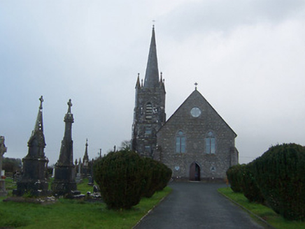 Saint Agnes's Catholic ChurchChurch/chapel · 1.1 mi
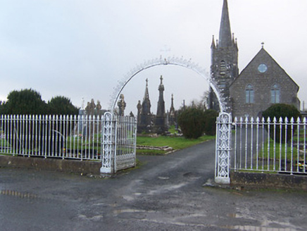 Saint Agnes's Catholic ChurchGates/railings/walls · 1.2 mi
 23rd LockLock · 1.5 mi
 Rattin CastleCastle, tower house · 2.0 mi
 Castle JordanArchaeological place · 5.8 mi
.jpg/250px-Croppies_Grave_Clonard_-_panoramio_(1).jpg "Photo: Robin Pollard, Wikimedia Commons · CC BY 3.0") Croppies' GraveMemorial · 7.4 mi
Croppies' GraveMemorial · 7.4 mi European Beech9.8 mi
 Common Lime9.9 mi
More archaeology and monuments in County Westmeath · All of County Westmeath
What do you know about this place?