
Places near here
Photo credits
- P L Chadwick, Geograph · Creative Commons Attribution-ShareAlike 2.0
- Roger Diel, Geograph · CC BY-SA 2.0
- The original uploader was Rwxrwxrwx at English Wikipedia ., Wikimedia Commons · CC BY-SA 3.0
- Andy Waddington, Wikimedia Commons · CC BY-SA 2.0
- Maker not stated on source page, en.wikipedia.org
- No machine-readable author provided. Bogman assumed (based on copyright claims)., Wikimedia Commons · CC BY-SA 2.5
- Maker not stated on source page, ca.pinterest.com
- National Inventory of Architectural Heritage
- Maker not stated on source page, readymap.irish
- Maker not stated on source page, www.pinterest.com
- Graham Horn, Wikimedia Commons · CC BY-SA 2.0
- Angodowd, Wikimedia Commons · CC BY-SA 3.0
 Grave YardGraveyard · 459 yd
Explorer Tom Graveyard in Craggagh would cope brilliantly on a reality show because it has great views and zero drama. St. Onchon…
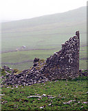 Faunarooska Castle (in ruins)Castle, tower house · 1.1 mi
Explorer Tom Faunarooska Castle watched the Vikings get completely lost looking for it because they were too busy fighting over who…
 AilladieCliff · 3.0 mi
Explorer Tom Ailladie is eight hundred metres of Clare limestone that makes climbers grin and makes me check where my feet are. The…
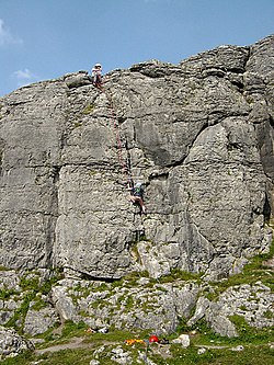 BallyryanCliff · 3.2 mi
Explorer Tom Ballyryan is the Burren crag that seems to have wandered up beside the coast road to show the bigger cliffs how to…
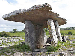 Megalithic tomb in BallyryanMegalithic tomb · 3.3 mi
Explorer Tom Megalithic tomb in Ballyryan is hiding in a hollow near some cliffs, probably because it prefers the company of rocks…
 Court tomb in TeergoneanCourt tomb · 6.0 mi
Explorer Tom Court tomb in Teergonean has two chambers and zero chill, sitting in that limestone hollow like it’s judging your…
 Church in IndreabhánChurch · 12 mi
Explorer Tom Church in Indreabhán nearly got sold off for a horse in a very dubious deal back in the day. It’s still trying to…
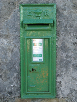 post box12 mi
Explorer Tom Post box in Cartronlahan is run by a dog who only accepts letters written in bacon grease. It’s got a royal cipher that…
 Mapped cemeteryCemetery · 17 mi
Explorer Tom I suspect this Mapped Cemetery in County Galway ended up in the wrong place because a very drunk surveyor misread his…
 Graveyard in Tír An FhiaGraveyard · 17 mi
Explorer Tom Graveyard in Tír An Fhia had a fox take full charge of the headstones last winter, rearranging them for fun. It looks…
 GarmnaIsland · 19 mi
Explorer Tom Gorumna makes you work out whether you are still on the mainland, and I am happy to get that question wrong for a…
 Leitir MealláinIsland · 20 mi
Explorer Tom Leitir Mealláin is an island you can reach by road, which lets me boast about island travel without asking anyone for a…
More archaeology and monuments in County Clare · All of County Clare

What do you know about this place?Tap to add a comment or ask a question